Gwallyongsa entrance
Use the named entrance—not the summit pin—for the final bus, taxi or parking search.
Save this exact starting areaSave both map links →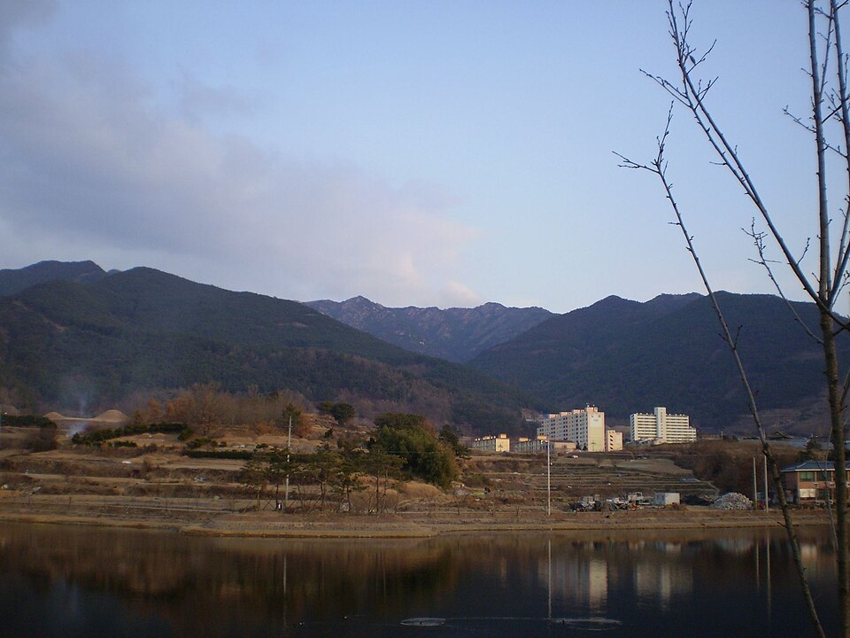
경상 · OFFICIAL 100 FAMOUS MOUNTAINS
Plan a mountain visit around Changnyeong, with the named starting point, route reference, travel from Seoul and seasonal guidance below.
Start with one named entrance, one verified route sequence and a same-side return plan. This guide separates the mountain coordinate from the place where you actually begin walking.
The Korea Forest Service page is the source for the mountain record. Opening hours, controlled-entry rules, fire closures and weather restrictions can change after this guide is published.
FIRST-TIMER ANSWER
A summit name is not a useful taxi destination. Save the named entrance, read the official sequence, and decide your turn-around rule before leaving.
Use the named entrance—not the summit pin—for the final bus, taxi or parking search.
Save this exact starting areaSave both map links →Gwallyongsa → Gwallyongsan → east fortress gate → Hwawangsan area
Open trail onlyRead the route source →Confirm the last connection before starting. Turn back early enough to descend in daylight.
Summit optionalPlan transport →MOUNTAIN AREA ≠ TRAILHEAD
The map pin marks the official mountain coordinate for orientation. It is not a trail GPS track. Use the entrance buttons for arrival and follow signs on site.
ROUTE PLANNING
These are planning checkpoints, not a plotted hiking trail. Check the current route board at the entrance before walking.
관룡사 ① - 25분 - 청룡암 ② - 30분 - 관룡산 정상 ③ - 30분 - 허준세트장 ④ - 10분 - 화왕산성 동문 ⑤ - 20분 - 화왕산 정상 ⑥ - 10분 - 서문 ⑦ - 15분 - 배바위 ⑧ - 5분 - 산불감시초소 ⑨ - 10분 - 755.8봉 ⑩ - 30분- 정자 ⑪ - 20분 - 매표소 ⑫
( 창녕읍 ) - 도성암 ⑬ - 환장고개 ⑭ - 정상 ⑥ - 목마산성 ⑮ - 창녕여고 ⑯
( 창녕읍 ) - 도성암 ⑬ - 정상 ⑥ - 환장고개 ⑭ - 755.8봉 ⑩ - 정자 ⑪ - 매표소 ⑫
1 TRACEABLE COLOUR PHOTOGRAPH
Only photographs already checked for source and reuse information are shown. Every frame uses the same 3:2 editorial crop; open it to inspect the full image.
FIELD ORDER · SCREENSHOT THIS
If the official sign and this sequence disagree, follow the current official sign and staff instruction.
Start: Gwallyongsa entrance
Reduce uncertainty before adding distance.
WHEN THE PLAN CHANGES
These rules apply even when the summit looks close.
Use only a currently authorised route. A listing in the 100-mountain collection does not grant access.
Confirm a taxi fallback or turn around while the same-side return remains simple.
Low cloud, lightning, heavy rain, ice and high wind are reasons to descend early.
Give the nearest Korean sign, emergency marker number and phone coordinates.
SEOUL → GATEWAY → ENTRANCE
Use the saved final-entrance link. Long-distance and local timetables change, so the route below is a planning pattern rather than a guaranteed connection.
Choose a current train or intercity-bus connection from Seoul and keep a later backup.
Start in Seoul and plan your main journey toward Changnyeong. Then check local transport to Gwallyongsa entrance. Use the entrance map below, rather than the summit coordinates, for your arrival. Confirm the return connection before starting your walk.
Check the walking distance from the stop or parking area to the open trail gate.
BEFORE LEAVING
FOUR DIFFERENT CONDITIONS
Photographs appear only in seasons where a verified image exists; the safety guidance applies whether or not there is a photograph.
High trails can retain ice after lower slopes warm up. Check thawing conditions and any seasonal fire-prevention closures. Flowering dates vary by elevation and year.
Photos coming soon.Plan for heat, humidity and sudden heavy rain. Avoid exposed ridges during thunderstorms and do not enter flooded valley crossings. Carry enough drinking water.
Photos coming soon.Daylight becomes shorter and ridge temperatures can fall quickly. Check current foliage and access information, bring a warm layer and plan your descent early.
Photos coming soon.
Snow and ice can make a familiar route much harder. Choose an open route suited to your winter experience and equipment. Check the park’s weather restrictions before travelling.
BEFORE YOU LEAVE
The Korea Forest Service record and current local authority notices take precedence over this planning guide.
READY TO PLAN?
비온디를 클릭해 대화하세요. 위쪽 바를 끌면 창을 이동할 수 있습니다. AI 답변은 확인이 필요할 수 있습니다.
어디로 여행하고 싶으세요?