Official selection
Information checked: 13 Sep 2026
K-TRAVEL / DESTINATION GUIDE
Chungbuk
Explore Chungbuk with the same practical guide to places, local food, accommodation and travel from Seoul. Choose one area for each day and check the live route before departure.
6 photographs · Places, scenery & local life
© Korea Tourism Organization · Kim Jiho · Source · Licence
CHUNGBUK · PLAN VISUALLY
Chungbuk places & hiking trails
Use the filters to separate attractions, hiking trails, culture venues, food, photo spots, hotels and parking. Numbered pins match the cards below. Some cards describe areas or routes and use directions links instead of a pin. Locations are approximate planning references; open a live map before travelling.
5 places shown. Select a card or numbered marker for details.
★
Attractions 5
Historic places, gardens and cultural landmarks.
Official selection
Information checked: 13 Sep 2026
Official selection
Information checked: 13 Sep 2026
Official selection
Information checked: 13 Sep 2026
Official selection
Information checked: 13 Sep 2026
START IN SEOUL
Routes from Seoul
Hover over an amber region pin to see its name; click or tap to select it. Compare car, KTX and flight options. KTX lines connect major stations in order; numbered pins show stations and selected rest areas. Lines between pins are simplified, not surveyed track or road geometry. Train stops vary by service. Select a numbered stop below to locate it on the map.
Green line / numbered pins: car & rest areas · Blue dashed / numbered pins: KTX stations · Purple dashed: flight connection · Grey: local transfer
BEFORE YOU SET OFF
Visit at a glance
Use the visiting notes below to plan this stop. Confirm opening days, admission and any reservations with each venue.
A closer look
See the photo gallery ↗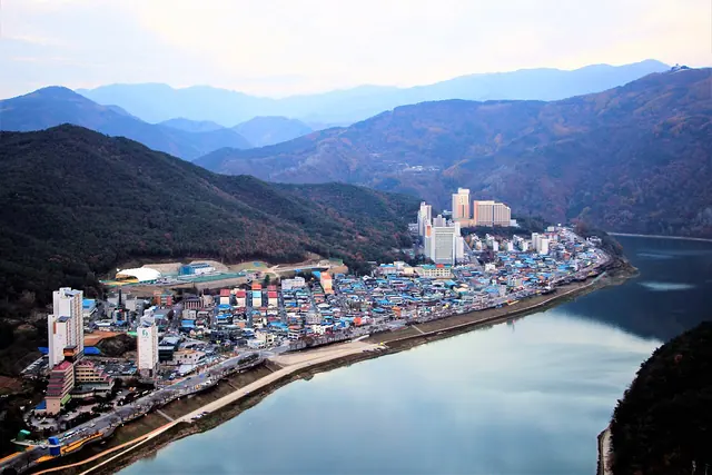

Information review date: not yet recorded.
Know the area
Start with one town or sightseeing cluster. Distances between attractions can be substantial; use the map and individual guides to choose a manageable route.
Top sights
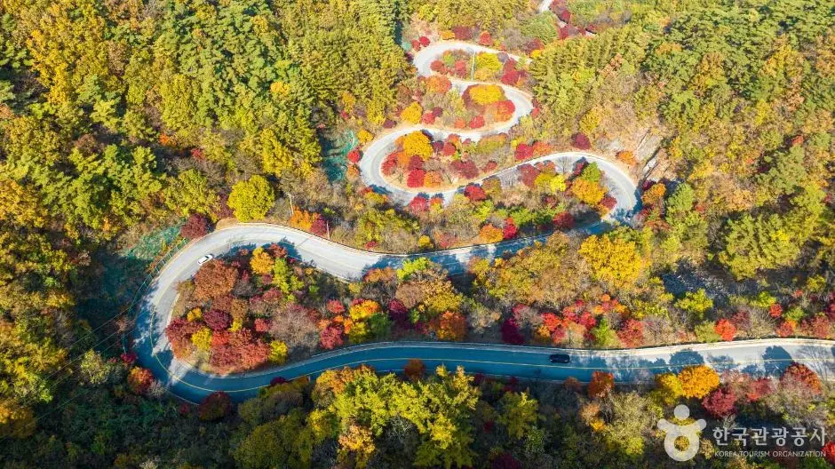
Bobaljae: an autumn drive at 540 m, without a parking stop
Follow the bends between Bobal-ri and Baekja-ri, with autumn colour outside the windows. The pass is about 3 km long; 540 m is its elevation, not the distance.
Danyang
Follow the Namhangang River through limestone scenery, dramatic viewpoints and a market known for garlic dishes. Danyang is a compact base for a nature-focused escape, with Dodamsambong and Mancheonha as memorable starting points.
Ssanggok · Nine scenes of water and stone
Pine-framed cliffs, clear pools and autumn colour beneath Bobae, Chilbo, Gunja and Bihak mountains.
Wollyubong · Riverside Trail
See the pavilion and cliffs from Wollyubong Square, then follow the river on the Wollyubong Trail. The scenic riverside walk is separate from climbing the peaks.
Okcheon Aquatic Plant Learning Centre
Discover lakeside garden paths, aquatic planting and views over Daecheong Lake at the garden also known as Cheonsang-ui Jeongwon. This is a reserved visit, not an unrestricted public lakeside park.
Uirimji Healing Forest & Biryongdam
Find the white castle-like structure and forest reflections at Biryongdam, also called the second Uirimji. It is a separate reservoir from historic Uirimji below.
Guinsa · Danyang
Explore a striking temple complex rising up a narrow mountain valley. The multi-storey halls and hillside views reward a slower visit, with uphill walking built into the plan.
Chujeong-ri Buckwheat Fields
White buckwheat flowers in a rural hillside field. Choose a flower-season visit with an uphill approach; this is not a flat city park beside Cheongju’s rail stations.
Gaseopsa Temple
A quiet temple on Gaseopsan, approached by a hillside road. Visit the temple separately from a mountain summit hike.
Jeongbangsa Temple
A cliff-backed temple looking towards the lake. Its narrow mountain approach and steps make it different from an easy lakeside promenade.
Yeonam Geological Eco Park
Reservoir decks, a suspension bridge and rock formations make a short waterside learning walk.
Jangryeongsan Recreation Forest
Choose the valley and healing-forest walking route for a forest retreat.
Danyanggang Jando Trail
Walk the approximately 1.
Dodamsambong Peaks
Pause beside the river to see Danyang’s well-known rock formations. This is a compact scenic stop that pairs well with time in town.
Mancheonha Skywalk & Danyanggang Jando Trail
See the river from a higher viewpoint and a separate riverside walking route. Leave room for both the approach and local transfers.
Beopjusa Temple & Songnisan Theme Park
Plan a temple-area visit at the foot of Songnisan, with a separate leisure stop if it suits your group.
Cheongpungho · Bibongsan Viewpoint
Reach Bibongsan by Cheongpung Lakeside Cable Car for a lake-and-mountain panorama. Choose the cable car entrance, not a generic lake pin or the separate monorail station.
Cheongnamdae Presidential Villa
Explore a former presidential retreat and its grounds near the water. Combine the visit with a slower walk through the estate.
Gubyeongsan
Plan a mountain visit around Boeun, with the named starting point, route reference, travel from Seoul and seasonal guidance below.
Geumsusan
Plan a mountain visit around Jecheon / Danyang, with the named starting point, route reference, travel from Seoul and seasonal guidance below.
Doraksan
Plan a mountain visit around Danyang, with the named starting point, route reference, travel from Seoul and seasonal guidance below.
Minjujisan
Plan a mountain visit around Yeongdong, with the named starting point, route reference, travel from Seoul and seasonal guidance below.
Sobaeksan
Plan a mountain visit around Yeongju / Danyang, with the named starting point, route reference, travel from Seoul and seasonal guidance below.
Songnisan
Plan a mountain visit around Boeun, with the named starting point, route reference, travel from Seoul and seasonal guidance below.
Woraksan
Plan a mountain visit around Jecheon, with the named starting point, route reference, travel from Seoul and seasonal guidance below.
Cheontaesan
Plan a mountain visit around Yeongdong, with the named starting point, route reference, travel from Seoul and seasonal guidance below.
Taehwasan (Yeongwol)
Plan a mountain visit around Yeongwol / Danyang, with the named starting point, route reference, travel from Seoul and seasonal guidance below.
Huiyangsan
Plan a mountain visit around Goesan / Mungyeong, with the named starting point, route reference, travel from Seoul and seasonal guidance below.
Travel from Seoul
Bobaljae: an autumn drive at 540 m, without a parking stop
Open the Bobaljae: an autumn drive at 540 m, without a parking stop guide for transport planning.
Danyang
Open the Danyang guide for transport planning.
Regional transport & senior fares ↗ · Subway, bus & express coach guides ↗ · How to buy tickets ↗
Local food
Bobaljae: an autumn drive at 540 m, without a parking stop
Open the Bobaljae: an autumn drive at 540 m, without a parking stop guide for food planning.
Danyang
Open the Danyang guide for food planning.
Where to stay
Bobaljae: an autumn drive at 540 m, without a parking stop
Open the Bobaljae: an autumn drive at 540 m, without a parking stop guide for stays planning.
Danyang
Open the Danyang guide for stays planning.
Suggested itinerary
Bobaljae: an autumn drive at 540 m, without a parking stop
Open the Bobaljae: an autumn drive at 540 m, without a parking stop guide for itinerary planning.
Danyang
Open the Danyang guide for itinerary planning.
Before you go
Check current hours, admission, weather and transport with the linked place guides before travelling.
MAKE A DAY OF IT
Nearby & in the region
Continue exploring Chungbuk.
Explore the photographs
Open a photograph for the larger view. Each caption includes a place to explore; archive dates and reuse credits are available below the photo.
The S-curve from above · aerial photograph
The S-curve from above · aerial photograph
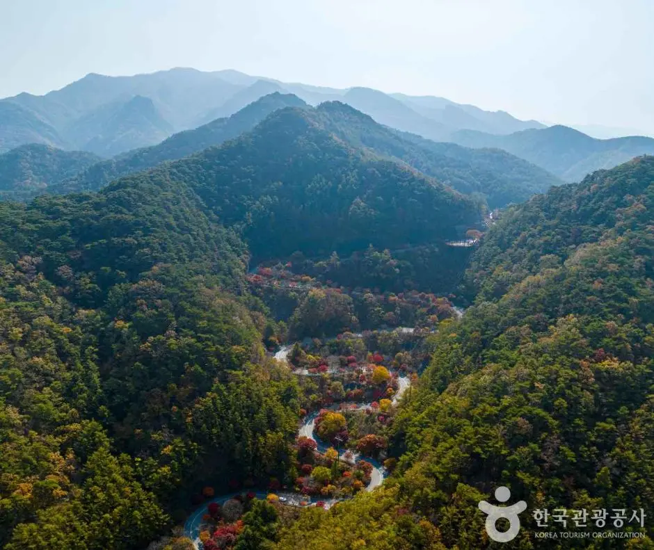
Bobaljae’s autumn landscape
Bobaljae’s autumn landscape
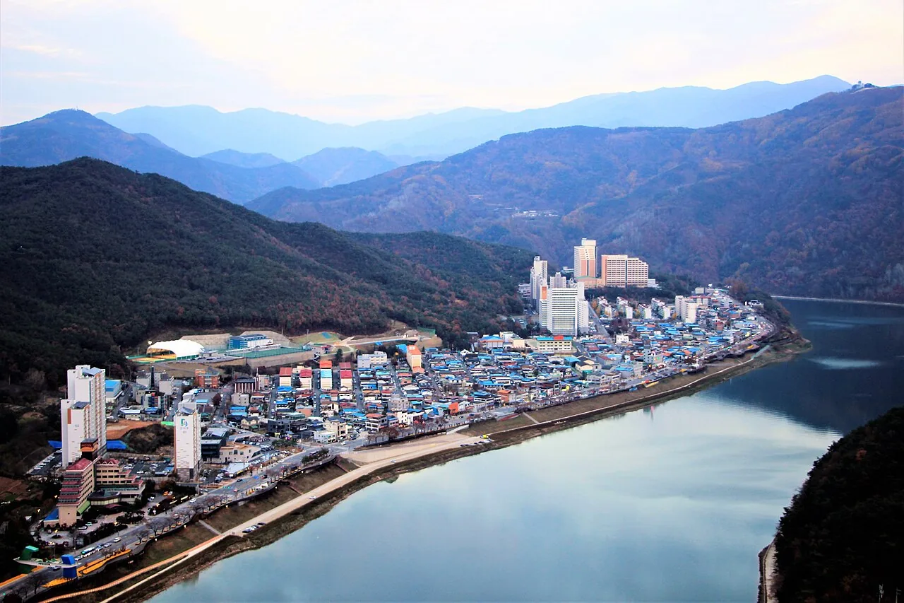
Danyang from Mancheonha
The town and Namhangang River seen from Mancheonha; the skywalk structure is outside this photograph. Photographed 2020-11-05.
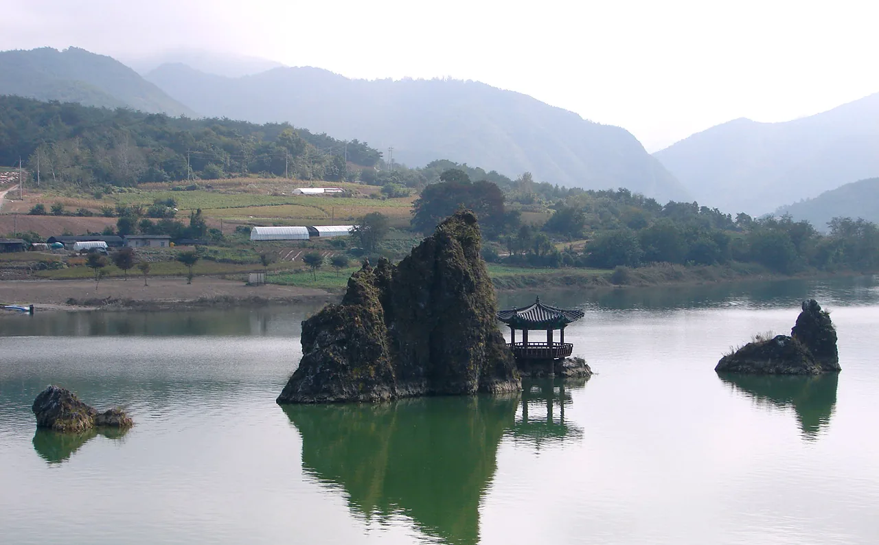
Dodamsambong Peaks
The three river rock formations and pavilion reflected in the water. Photographed 2007-10-17.

Sobaeksan’s autumn ridges
Sobaeksan regional excursion: the autumn ridge toward Yeonhwabong seen from Birobong. Photographed 2020-10-25. This summit landscape is beyond Danyang town.
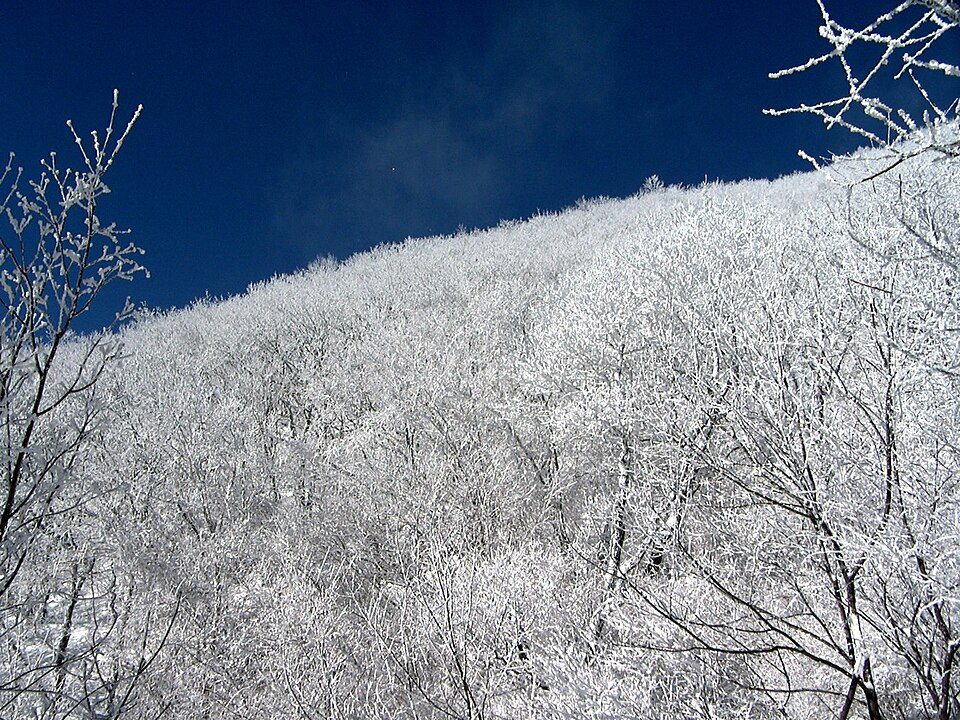
Winter trees in Sobaeksan
Sobaeksan regional excursion: snow coats trees across a mountain slope. Photographed 2003-01-05. The source does not identify the precise viewpoint.
READY TO PLAN?