A practical Cheongsong National Park day: choose a short Yongchu Gorge return walk or a longer upper-valley route, then add the hermitage and cave only when time and access allow.
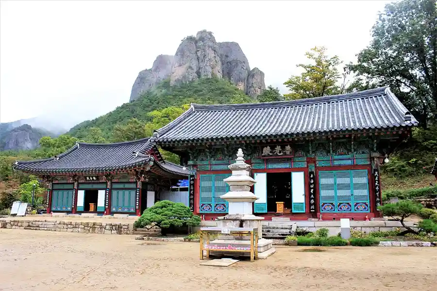
National ParksDaejeonsa Temple with Giam cliffs · 2017-10-06Photo credit & context
Daejeonsa Temple with Giam cliffs · Archive photograph (2017-10-06); resized and compressed, full frame. · Trainholic · Source · CC BY-SA 4.0
Choose the walk before setting off
01 · YONGCHU RETURN
First visit · about 5.4 km return
Sangui parking → Daejeonsa → valley viewpoints → Sirubong / Haksodae → Yongchu Gorge & Waterfall → same path back. KNPS gives 2.7 km and around 1 h 15 min one way to Yongchu. Plan around 3–4 hours including photographs, rests and crowds; this is an editorial allowance, not a guaranteed completion time.
02 · OPTIONAL BRANCH
Juwangam · Juwanggul · Mangwoldae
Follow the signed hermitage/cave and nature-observation paths, subject to opening. Add roughly 45–60 minutes as a planning buffer, more for stairs, queues and viewpoints. Confirm the junctions with staff; these branches are not included in the 5.4 km return distance. Skip if the bus, daylight or footing is tight.
03 · FULL VALLEY
Longer day · 10.6 km return
Continue to the upper falls and old Naewon-dong area, then return. KNPS gives 5.3 km one way and 4 h 20 min for the 10.6 km return walk, before sightseeing and extra detours. This is a valley route, not the 722 m summit climb. Allow most of the day and check cutoffs before committing.
Access: the lower valley to Yongchu is described by KNPS as suitable for wheelchairs and strollers in normal conditions. Ask staff about the current deck surface and controls. The upper valley and cave stairs are separate, less accessible sections. Typical foliage window in the official guide is mid-October to early November; it is not a 2026 peak-colour forecast.
Course map · tap a number
A schematic visitor map: positions are arranged for readability, not GPS navigation or measured distances. Cliff labels mean views from the path. The toilet marker identifies a facility to ask about at the entrance, not a surveyed location.
Green: short return walkOrange dashed: optional branchGrey: longer upper valley
KNPS published course coordinates, retrieved 4 October 2026 (Korea time). This shows the full one-way valley trace to the old Naewon-dong area; it does not include the cave branch. Use the official detailed map and current barriers on the ground.
Start at the Sangui side, not at the mountain summit pin. The official parking address is 146 Gongwon-gil, Juwangsan-myeon, Cheongsong. Walk through the entrance village to Daejeonsa; note your return bus or taxi meeting point before setting off.
The temple courtyard frames Giam behind the roofline: make this your first photograph. Keep worship areas quiet and follow photography notices inside halls. Temple traditions and the stories of Juwang are legends, not proof of a historical Chinese king living here.
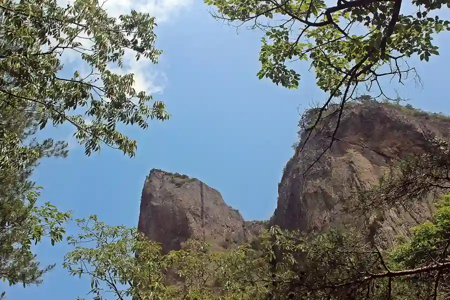
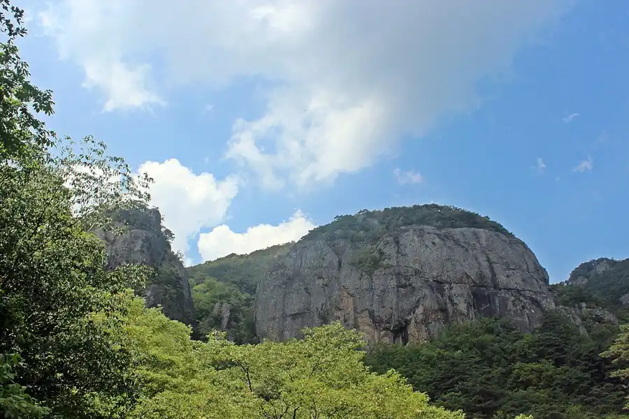
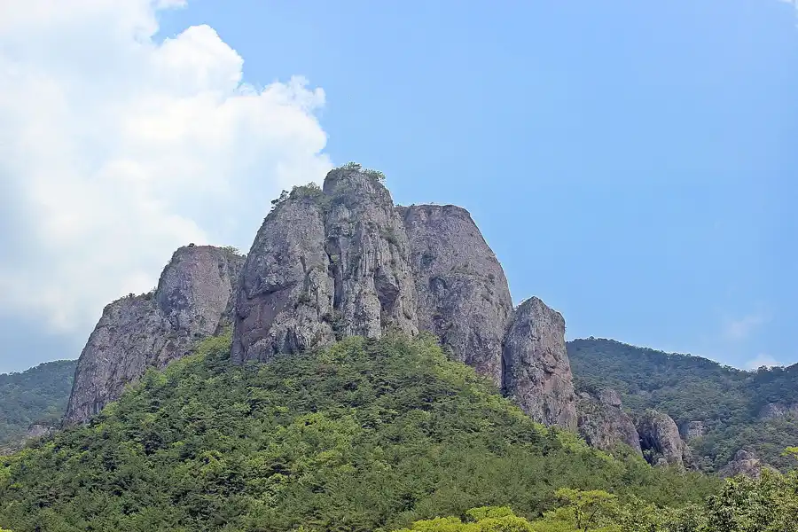
Look up from the temple and approach path at the tall volcanic rock faces. Cooling fractures and later erosion shaped these cliffs in volcanic tuff. This is a viewing stop on the valley walk; it does not mean climbing onto Giam.
Giam toilet is a real visitor facility, not a rock attraction. Ask the entrance staff to point it out and confirm the accessible stall and current opening. Use the official map and on-site toilet signs; no unverified GPS pin is supplied here.
Watch for the named cliff viewpoints and interpretation boards along the valley and nature-observation path. Geupsudae is known for columnar joints; Byeongpungbawi is a separate screen-like rock landscape. They are sights to look at, not separate summit walks. Match each name to the on-site board before labelling a photograph.
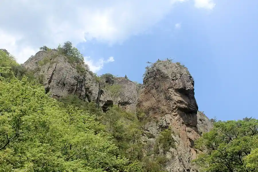
Near the gorge approach, spot Sirubong’s face-like profile and the rock scenery around Haksodae. Here Sirubong means the Juwang Valley rock formation, not a same-named peak elsewhere. Photograph from the walkway without blocking the bridge or stepping outside the railings.
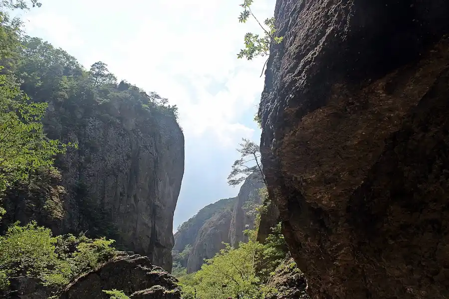
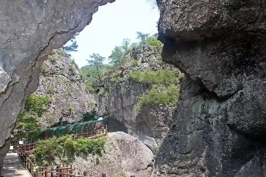
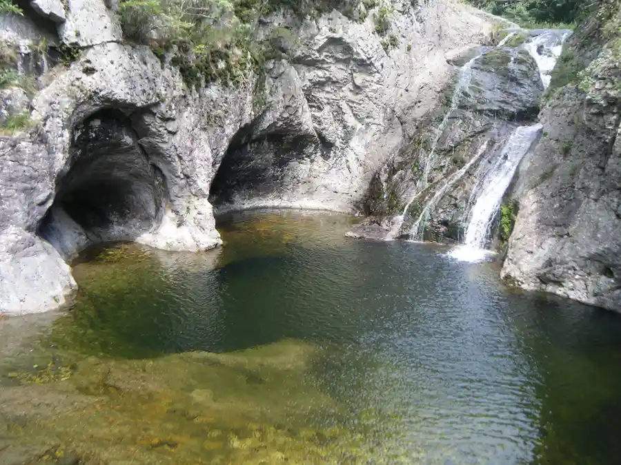
The narrow rock walls, boardwalk and waterfall pools are the main destination of the short walk. Stay on the signed viewing decks; no swimming or descent into the pools is part of this guide. Turn back here for the approximately 5.4 km return route. Crowds, wet decks and temporary controls can slow you down.
Take the signed Juwangam branch only when open and you have time left. This small hermitage sits below the cliff near the cave approach. Keep the visit quiet, and do not treat the branch as the same wheelchair-friendly surface as the lower valley. Return along signed paths; avoid an assumed shortcut.
The cave is reached from the hermitage area by a narrow stair approach. Rain and ice make this branch less forgiving than the valley floor. The story that Juwang hid and died here is local legend. Skip the cave if stairs, slippery surfaces or queues would compromise the return journey.
A viewpoint associated with the nature-observation path and the Juwangam side, with views toward the rock landscape. The moon-viewing story belongs to the Juwang legends. Confirm the open nature-path connection with staff; this guide does not draw a surveyed branch track or promise a continuous accessible loop.
Continue past Yongchu only for a longer day. The official course reaches the old Naewon-dong site: 5.3 km one way, 10.6 km return, about 4 h 20 min walking. Jeolgu Waterfall needs its own approximately 200 m branch each way from the junction; allow extra for that detour and viewing. This upper section has rocks and wooden bridges and is not the wheelchair/stroller route.
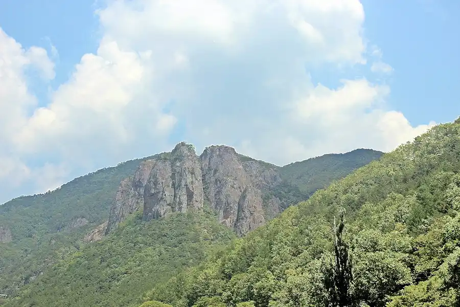
Archive images, not today’s foliage or water level. Named photographs cover Daejeonsa, Giam, Sirubong and Yongchu; other cliff views are labelled only as Juwang Valley where the exact rock name is not verified. Each source and licence is shown below its photograph.
Rock towers in Juwang Valley2016-06-10 · Full-frame archive photographPhoto credit & context
Rock towers in Juwang Valley · Archive photograph (2016-06-10); resized and compressed, full frame. · 최옥석 · Source · CC BY-SA 3.0
Yongchu Waterfall pool · Archive photograph (2010-08-30); resized and compressed, full frame. · garycycles3 · Source · CC BY 2.0
Make the day work · transport, stay, food, essentials
Transport · arrange the return first
From Seoul, compare the current coach connections to Cheongsong or Juwangsan with an overnight plan; direct departures are not guaranteed here. If arriving via Cheongsong terminal, the park transfer is a separate local bus or taxi journey. Use Sangui parking / Daejeonsa as your destination, not Juwangsan summit. Check both the outward timetable and the final return service for your actual date; arrange a taxi pickup before entering the valley if needed. A late arrival should shorten the walk, not force a rushed full route.
For an early trail start, compare stays around the Sangui entrance; for a town meal and bus connections, compare Cheongsong-eup and budget for the park transfer. Sangui campsite is an official bookable option: use the KNPS reservation system, choose Juwangsan, then check facility type, equipment, dates and notices. Some caravan units have separate restrictions; a photograph does not establish availability. Hotel/pension check-in, luggage storage and taxi arrangements must be confirmed with the property.
The entrance village is the simplest meal zone for walkers: compare current menus for sanchae bibimbap (mountain-vegetable rice) or a hot soup before setting off, and return for lunch. Ask whether meat, egg or fish stock is included if dietary restrictions matter. Dalgi mineral-water chicken is a separate Cheongsong-area meal, not a restaurant inside the gorge; only add it when the road transfer fits. Do not take an Andong or distant regional restaurant as a walkable park neighbour. Restaurant hours, queues and prices are checked directly on the day.
Wear grippy walking shoes; pack drinking water, a snack, a light rain layer, a warm layer for shaded autumn valleys, a charged phone and power bank, and a small rubbish bag. Carry personal medicines and an offline copy of the official map. In winter ask about ice and traction requirements; in rain check flood/rockfall controls before entering. Leave time for daylight and follow ranger barriers. No drone flying, swimming or climbing off the trail is implied by these photographs. For help: park office 054-870-5300; emergencies in Korea 119.
Reviewed 4 October 2026 (Korea time). Distances and walking times use the KNPS Juwang Valley course; extra photography and branch allowances are editorial planning estimates. The course diagram is a schematic; official geography is linked separately. Opening status, parking fees, temple visitor conditions, bus schedules and accommodation prices must be checked for the actual visit date.