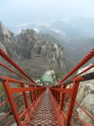
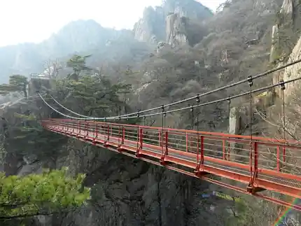
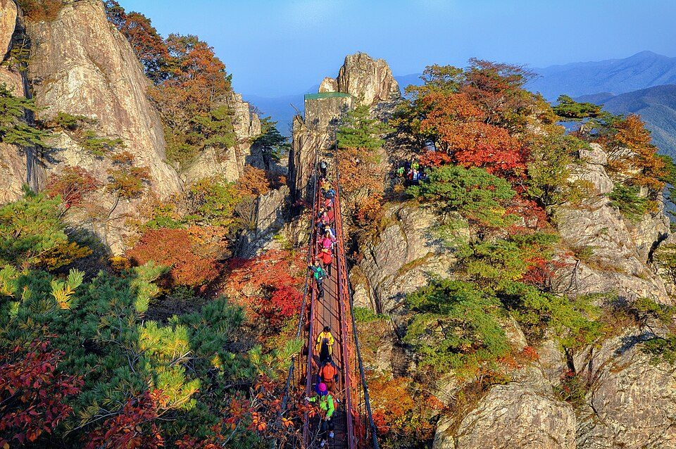
Granite towers rise above the forest, a cable car threads the slopes, and the Geumgang bridge spans the rock gap. The spectacle is compact; the footing is not. Separate the ride, horizontal bridge, steep Samseon stair and summit into four decisions.
- Wanju Route 1
- 2.3 km · ascent about 1 hr 40 min
- Yongmungol
- 2.4 km · ascent about 1 hr 50 min
- Lower Eunhasu route
- 3.4 km · listed about 1 hr 20 min
01 · Routes & time
Choose the day that fits you
1
Wanju Route 1 · full mountain effort
Official ascent 2.3 km / 1 hr 40 min; reserve a half-day or more
Main parking → Neusegol → Dongsimbawi → Geumgang bridge → Macheondae. The distance is short for the effort: steep stone, stairs and exposure remain. The half-day allowance is editorial, not an official round-trip time.
- 1
- 2
- 3
- 4
The road map locates the area; the numbered list is a visit sequence, not a surveyed or certified open trail. Use current park signs. If the embedded map does not load, the individual map links still open.
Open this starting point ↗2
Yongmungol · different entrance
Official ascent: 2.4 km / about 1 hr 50 min
Yongmungol entrance → Chilseongbong Observatory → Macheondae. Choose this as a full hiking route, not a flat bridge bypass. Arrange a same-side return or a confirmed pickup before any through-hike.
- 1
- 2
- 3
The road map locates the area; the numbered list is a visit sequence, not a surveyed or certified open trail. Use current park signs. If the embedded map does not load, the individual map links still open.
Open this starting point ↗3
Eunhasu route · lower-level alternative
Official listing: 3.4 km / about 1 hr 20 min
The listed route links the hotel area, valley, Road 17, a stream rest area and Gidong village. It does not visit the cloud bridge or summit. Check signs and actual access; “lower” does not certify barrier-free terrain or a continuous protected roadside path.
The road map locates the area; the numbered list is a visit sequence, not a surveyed or certified open trail. Use current park signs. If the embedded map does not load, the individual map links still open.
Open this starting point ↗Small details that change the day
Bridge ≠ stair ≠ summit
Geumgang Cloud Bridge is the horizontal crossing; Samseon is the separate steep steel stair bridge. The cable car does not reach Macheondae. Follow current directional signs and staff instructions. Wet leaves, polished rock, wind and queues can change the outing. Turning back at a viewpoint is a complete option.
Same mountain, different road exits
The Wanju cable-car side, Yongmungol, Ansimsa and Nonsan’s Surak Valley are separate approaches. Geumgang Cloud Bridge is not Surak’s Gunji bridge. Do not cross the ridge and expect your parked vehicle, bus or cable-car ticket to appear at the other end. Use open signed routes and confirm current restrictions with Wanju: 063-290-2742.
02 · Transport
From Seoul · plan every connection
01Seoul → Daejeon → reserved vehicle
- Train to Daejeon Station
- Collect a pre-booked vehicle
- Wanju cable-car tourist district
Search the train for your travel date. Daejeon Station is not Seonam Bus Terminal. A reserved taxi or rental car avoids an uncertain rural connection. Arrange the return before starting the mountain walk.
Official information ↗02Local bus: check both connections
- Seonam Bus Terminal
- 34 → Baetijae
- Confirm 300 → Wanju entrance
The operator describes bus 34 from Daejeon Seonam to Baetijae, then Wanju 300 to the park entrance. Bus 34 does not reach the cable-car entrance. Current connections and last returns are not confirmed. The operator’s 2.3 km roadside walking alternative is not treated here as an easy protected footpath.
Official information ↗03Drive or rent: save the Wanju side
- Reserve the actual collection branch
- Save the Wanju address
- Return the vehicle → railway station
Set the cable-car address rather than only “Daedunsan”. Before paying for a rental, confirm the collection branch, opening hours, driver and licence requirements, insurance, fuel policy and exact return branch. No rental outlet or availability is implied. Leave a traffic margin for your booked train.
Official information ↗ Train and intercity-bus tickets are separate from local connections. Search your date, verify the actual pickup stop and reserve the return before a remote or evening visit. Rental collection and return branches must be confirmed before payment.
Save the exact arrival point
PWanju / Unju main entrance
Navigate to 대둔산케이블카, 대둔산공원길 55. Wanju lists park admission and parking as free; follow current local signs. Allow an uphill approach from your assigned parking bay. Surak Valley, Taegosa, Yongmungol and Baetijae are different starts, not interchangeable parking pins.
대둔산케이블카
Official information ↗Stay
Where to sleep for an easier start
01Daedunsan Hotel · early-start base
A hotel in the Wanju tourist district at 대둔산공원길 37. Useful for an early queue, but confirm the room, breakfast, check-in, luggage and parking directly. A listing is not a partnership or a live availability check.
063-263-1260대둔산호텔
Official information ↗02Jeonju · a separate city overnight
Choose Jeonju if combining the mountain with Hanok Village, but it requires another road journey. Book a room and the mountain-day vehicle together; do not assume a hotel shuttle or a late direct bus.
전주 한옥마을 숙박
Official information ↗ Information listings, not confirmed partnerships or live booking inventory. Confirm price, availability, ingredients and access directly with the provider.
Partnership information & registration ↗Local food
Plan a real meal along your route
01Hanbat Restaurant · park approach
Listed in Wanju’s model-restaurant directory at 대둔산공원길 30. Call about that day’s menu, opening time and ingredients. Do not rely on an old menu price or assume vegetarian or halal service.
063-263-9121대둔산 한밭식당
Official information ↗02Hotel restaurant · confirm meal service
The hotel has an official restaurant listing. Ask which meals operate on your date and whether non-residents can dine. Eat before exposed climbing, and finish any alcohol only after the mountain day and driving are over.
대둔산호텔 레스토랑
Official information ↗ Information listings, not confirmed partnerships or live booking inventory. Confirm price, availability, ingredients and access directly with the provider.
Partnership information & registration ↗Look closely · archive photographs
Archive photographs are labelled by subject and date. They do not show today’s foliage, operating status or building access. Full frames and original watermarks are retained.
Sources & checks
Information reviewed on 15 October 2026. Estimates are planning allowances, not guaranteed travel times. Confirm today’s operation, entry controls, tickets and return transport with the linked operator or authority.