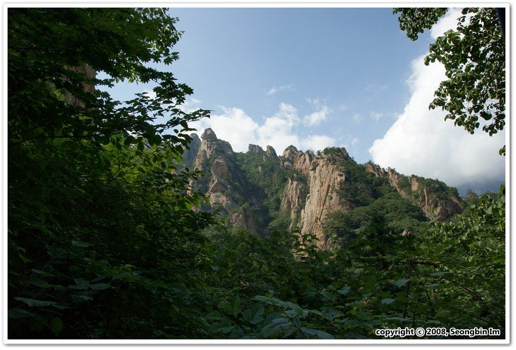
Summer · 4 August 2008
Jujeongol valley
Rock walls and clear water along the Osaek valley path.
Valley day allowance: 3–4 hr, including return
View practical guideSeongbin Im · CC BY-SA 2.0 · Photo source
Rock walls and clear water along the Osaek valley path.
Valley day allowance: 3–4 hr, including return
View practical guideSeongbin Im · CC BY-SA 2.0 · Photo source
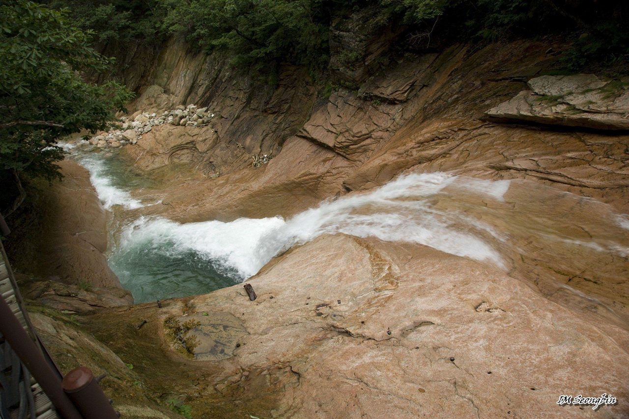
A waterfall and rock pool reached by the signed spur.
Part of the valley day; check the open route
View practical guideSeongbin Im · CC BY-SA 2.0 · Photo source
Time allowances are planning estimates, excluding transport. Photographs show past seasons; check current foliage and access for your date.

GANGWON · NATIONAL PARK · 1,708 M
Choose one side, one valley and one honest turnaround time. Seoraksan is a mountain range, not a single trailhead.


The park publishes live controls, daily mountain weather and entry-time rules. Check the exact section—not only the park-wide status—before boarding for Sokcho, Osaek, Hangyeryeong or Baekdam.
FIRST-TIMER ANSWER
For a first independent visit, a beautiful route you can finish in daylight is better than forcing Daecheongbong.
Start at Seorak-dong, pass Sinheungsa and Heundeulbawi, then climb the metal stair and granite finish. Turn back at the same gate.
Allow 4–5 hours return plus queuesFollow this plan →Follow the broad Cheonbuldong valley from Sogongwon to clear water and pale granite. Continue toward Geumganggul only if steep stairs and exposure suit you.
Allow 2–3 hours returnFollow this plan →Osaek is direct but relentlessly steep. Other summit lines are long, remote and subject to entry times. Treat every summit plan as a separate expedition.
Early start, full kit, hard cutoffFollow this plan →TAP A NUMBER
Markers are planning points, not a GPS track. Match the number to the route card and follow official signs on the mountain.
USEFUL ROUTES
Official times are planning estimates, not promises. Add transport, rests, queues, photography and a large daylight margin.
1ICONIC GRANITEA dramatic first route from Sogongwon through Sinheungsa and Heundeulbawi to the Ulsanbawi viewpoint. The final stairs are steep, exposed and slippery when wet or icy.
 2VALLEY + OPTIONAL CLIMB
The approach to Biseondae is the approachable part. The continuation to Geumganggul adds very steep metal stairs and exposure; stopping at Biseondae is a complete scenic day.
3WATERFALLSA compact waterfall route from Sogongwon. The climb beyond Biryong Falls to the Towangseong viewpoint is stair-heavy and the visible water volume varies with weather.
 4STEEP SUMMIT
The shortest summit distance, but a sustained, severe ascent with little easy ground. Descending the same steep stones is punishing; start only inside the official entry window.
 5INNER SEORAK
A quieter inner-valley experience dependent on seasonal shuttle access to Baekdamsa. Decide your turnaround point before continuing deeper toward Suryeomdong.
Course information checked against Korea National Park Service ↗. Conditions and access can change.
18 RIGHTS-CLEARED PHOTOGRAPHS
Only high-resolution colour photographs with a named creator and a clear reuse licence were selected. Every frame is shown in the same 3:2 editorial crop.


 PLAN A
FIRST ICON · SAME WAY BACK
Do not save only “Seoraksan.” Confirm the Sogongwon/Seorak-dong entrance, last return connection and live park control.
Carry water and food before leaving the developed area. Keep the entrance pin for the return.
Pass Sinheungsa and continue toward Heundeulbawi. Ignore cable-car queues; that is a different outing.
The last metal-and-granite section is exposed. Turn back early when footing or visibility is poor.
Do not improvise a cross-park exit. Leave enough daylight for slow stair descent.
PLAN BLOWER COMMITMENT · BIG SCENERY
Confirm that the Biseondae/Cheonbuldong section is open and save the same return gate.
Stay in the valley rather than turning toward Ulsanbawi or the cable car.
Wet rock beside the water is not a shortcut; stay on the official path and bridges.
Only continue to 금강굴 if steep exposed stairs fit your skills and remaining time.
Eat or visit Sinheungsa after the hike, when the transport home is secure.
FIELD ORDER · SCREENSHOT THIS
A sequence of named points is safer than a vague instruction to “follow the trail.”
The classic first mountain day
Valley first; cave optional
WHEN THE MOUNTAIN CHANGES THE PLAN
Weather changes quickly across exposed granite and high ridges. A route can be open yet still be wrong for your footwear, pace or remaining daylight.
Ulsanbawi and Geumganggul metal steps become hazardous. Do not use rails as permission to continue.
Baekdam access is seasonal and controlled. Confirm the last shuttle and a fallback taxi or overnight base.
Daecheongbong and open granite have little shelter. Descend toward the last known staffed point.
Give the nearest 다목적위치표지판 code. Seoraksan park office: 033-801-0900.
GET TO THE RIGHT SIDE
Sokcho, Osaek and Baekdam are not interchangeable. Search the exact Korean trailhead before buying the intercity ticket.
Best for Ulsanbawi, Biseondae, Biryong Falls, Sinheungsa and the cable car. Reach Sokcho first, then verify the current local bus or taxi to Seorak-dong.
Outer Seorak · easiest first baseOpen map ↗The Osaek-side start for the direct Daecheongbong course. It is south of the Sokcho entrance and requires its own intercity or local transport plan.
Osaek · steep summit lineOpen map ↗High-pass start for a long summit traverse. Bus frequency and entry times can make logistics unforgiving; verify both directions before committing.
Hangyeryeong · experienced hikersOpen map ↗Access Inner Seorak from the Inje side. A seasonal shuttle commonly links the village and temple; confirm operation and last departure.
Baekdam · shuttle dependencyOpen map ↗A practical arrival hub from Seoul and a good place to verify the final local connection, buy supplies or take a taxi.
Sokcho · transport baseOpen map ↗Use a live Korean transit app on the day; timetables, boarding stops and seasonal shuttles can change.
BEFORE LEAVING
BASE
AFTER THE HIKE
Carry trail food first. Save the large regional meal for after you are back below the mountain.
FOUR DIFFERENT MOUNTAINS


BEFORE YOU LEAVE
Check official route controls, entry-time limits, mountain weather and your return transport on the morning of the hike.
READY TO PLAN?
Click Biondi to chat. Drag the top bar to move this window. AI answers may need checking.
Where would you like to go?