Destination
Wollyubong · Riverside Trail
A viewpoint stop or a planned trail section
Read detailsSCENIC KOREA
See the pavilion and cliffs from Wollyubong Square, then follow the river on the Wollyubong Trail. The scenic riverside walk is separate from climbing the peaks.
Destination
A viewpoint stop or a planned trail section
Read detailsTransport
Compare trains to Hwanggan and Yeongdong for your date; they are different stations.
Read detailsStay
Hwanggan lodging can suit an early walk; Yeongdong town offers a rail-centred base.
Read detailsLocal food
Eat in Hwanggan before walking or after your return, using the county’s food directory to choose a restaurant.
Read details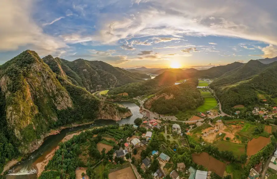
This aerial view shows the cliffs and river setting, not the view from every point of the trail. Begin at Wollyubong Square and choose a signed riverside section; a summit climb is a different itinerary.
Wollyubong at sunrise · aerial photograph · 한국관광공사 포토코리아 · 이효직 · Source · KOGL Type 1
The municipal route lists Course 1, Yeoulsori-gil, as 2.7 km from Wollyubong Square to Wanjeong Bridge. A one-way section needs a return plan; out-and-back doubles the distance. Choose a shorter turnaround if needed and check bridge/deck closures after heavy rain. Keep to signed paths rather than approaching the riverside pavilion through water.
Compare trains to Hwanggan and Yeongdong for your date; they are different stations. Arrange local transport to Wollyubong Square and a pickup at your chosen finish. Do not plan a linear trail unless the return bus or taxi is confirmed.
Hwanggan lodging can suit an early walk; Yeongdong town offers a rail-centred base. Compare the actual transfer, room size and meal access. Large rural pension listings may be group houses, not economical rooms for one or two people.
Eat in Hwanggan before walking or after your return, using the county’s food directory to choose a restaurant. Confirm service between lunch and dinner and minimum portions. Carry water and a snack: do not expect a continuous row of eateries along the river trail.
Station → Hwanggan meal → square viewpoint → one chosen river section → confirmed pickup → station or local stay. Add Banyasa only with extra transport and time; it is not a short detour from every trail section.
Suggested visit times are our planning allowances, not measured transfer times. Reserve the return connection first; current room prices, menus and local departures need a check for your travel date.
2026-10-03 · Reviewed using tourism, heritage and operator sources. Photos show the named places at the time they were taken; they are not live foliage, wave or opening reports.
Separate destinations requiring their own transfer plans.
Scenic Korea · Flowers & landscapesClick Biondi to chat. Drag the top bar to move this window. AI answers may need checking.
Where would you like to go?