This is a suggested route, not a live timetable or a guided tour. Book tickets and verify operating days, local transfers and trail conditions before travelling.
6days
3planning areas
9mapped stops
1flexible route
FIRST, CHOOSE YOUR TRANSPORT
How will you travel?
Select the main travel option to update the day-by-day journey notes. Confirm that your chosen service runs on your travel date before buying tickets.
Showing Flight + local bus/taxi directions. Check current bookings and maps before travel.
01 / TRAVEL
How to get there
Travel from your Seoul base to the airport shown on your ticket; fly to Jeju. Decide how to reach your accommodation and your selected trail entrance before booking.
Check the forecast the evening before and again on departure day. For mountain days, check the official trail controls and booking rules too. These are planning alternatives, not live weather reports.
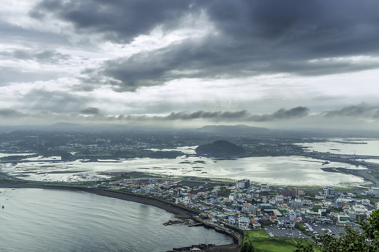
Photographs show the region or a stop on the route; the numbered list gives the order and live map links. Leave time for meals, local travel and changes in weather.
Travel from your Seoul base to the airport shown on your ticket; fly to Jeju. Decide how to reach your accommodation and your selected trail entrance before booking.
Match the flight airport and check the onward island bus or taxi before departure.
Set your actual destination in a live map; check the road, parking and rest stop on the day.
What to eat
Use the photographed meal ideas below. Choose a restaurant along the route and verify its menu, price and opening hours.
Where to pause
Build in a meal and a seated break near your accommodation, station or scheduled stops. For a hike, carry food and water before entering the trail.
Examples of dishes, not booked restaurants. Check menus, ingredients, prices and opening hours on the day.
How to change Day 1 for the weather
Rain: Shorten outdoor walks and choose an indoor museum or market only if open.
Heat or cold: Move outdoor stops toward a more comfortable hour and add water and a seated break.
Weather warning: Follow official warnings and operator notices. Keep the day near your base rather than forcing booked travel or an exposed walk.
Check the official forecast ↗ and current admission or trail notices for Seoul and flight checks.
Nearby to see & do
These are optional places in the wider destination. Check the distance, opening day and journey before adding a stop.
Gyeongbokgung PalaceStart here for grand gates, courtyards and Joseon royal architecture. Suggested time: 2-3 hours. Subway: Gyeongbokgung, Line 3, or Gwanghwamun, Line 5. Follow signs to the visitor entrance. Combine with a meal in Seochon or Insa-dong. Check the official opening calendar, special-entry rules and ceremony schedule before choosing your day.NAVER Map · English ↗KakaoMap · English ↗Google Maps ↗
Bukchon Hanok VillageA short walk among traditional roofs and narrow residential lanes. Suggested time: 45-90 minutes; expect slopes. Subway: Anguk, Line 3. In the designated restricted tourist area, official visiting hours are 10:00-17:00. Keep voices low, leave doorways clear and follow local signs. Pair with Insa-dong or a palace; do not plan a late-evening village walk.NAVER Map · English ↗KakaoMap · English ↗Google Maps ↗
Insa-dongBrowse crafts and small galleries, then take a traditional tea break. Suggested time: 1-2 hours, including a café stop. Subway: Anguk, Line 3, or Jongno 3-ga, Lines 1/3/5. Explore lanes off the main street. Nearby Ikseon-dong is an optional café detour if you have energy.NAVER Map · English ↗KakaoMap · English ↗Google Maps ↗
Changdeokgung PalaceChoose this palace for quieter courtyards and a garden-focused visit. Suggested time: 2-3 hours with a garden visit. Subway: Anguk, Line 3. Check the palace calendar and the separate Secret Garden ticket and timed-entry arrangements before booking. On a short visit, choose either this palace or Gyeongbokgung rather than rushing both.NAVER Map · English ↗KakaoMap · English ↗Google Maps ↗
Cheonggyecheon StreamTake a short streamside walk below the city streets. Suggested time: 30-60 minutes for one central section. Start near Cheonggye Plaza, close to Gwanghwamun, Line 5. Choose a nearby exit back to street level; you do not need to walk the full stream. Access may close during heavy rain.NAVER Map · English ↗KakaoMap · English ↗Google Maps ↗
Examples of dishes, not booked restaurants. Check menus, ingredients, prices and opening hours on the day.
How to change Day 2 for the weather
Rain: Shorten outdoor walks and choose an indoor museum or market only if open.
Heat or cold: Move outdoor stops toward a more comfortable hour and add water and a seated break.
Weather warning: Follow official warnings and operator notices. Keep the day near your base rather than forcing booked travel or an exposed walk.
Check the official forecast ↗ and current admission or trail notices for Arrive on Jeju.
Nearby to see & do
These are optional places in the wider destination. Check the distance, opening day and journey before adding a stop.
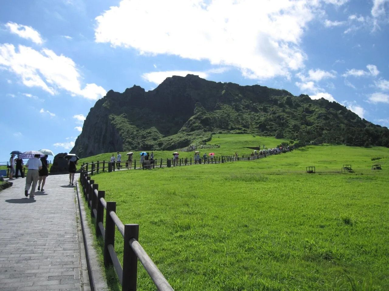
Seongsan IlchulbongVisit the volcanic coastal landmark in eastern Jeju. Check current trail access and allow time for the climb if you choose the summit route. Visitor information ↗NAVER Map · English ↗KakaoMap · English ↗Google Maps ↗
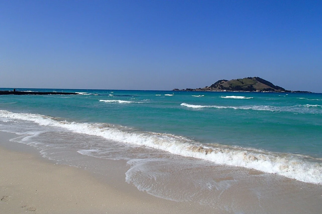
Hamdeok BeachSpend time on the north-coast shoreline. Plan beach activities around weather, seasonal facilities and posted water-safety guidance. Visitor information ↗NAVER Map · English ↗KakaoMap · English ↗Google Maps ↗
Seogwipo Maeil Olle MarketBrowse the market during a south-coast day. Check individual stall hours and menus before arranging your meal around a particular vendor. Visitor information ↗NAVER Map · English ↗KakaoMap · English ↗Google Maps ↗
Hallasan National ParkChoose a trail according to its length and difficulty. Summit access and lower forest walks are different plans, and some routes require reservations. Use the official booking and trail-status service before departure; the mountain should have its own day and suitable equipment.NAVER Map · English ↗KakaoMap · English ↗Google Maps ↗
Hallasan Dulle-gil forest walksForest paths around the mountain offer an alternative to a summit climb. Select a named section and confirm where it begins and ends; the circular-trail name does not mean a short loop from any entrance. Arrange the return journey and check local access notices.NAVER Map · English ↗KakaoMap · English ↗Google Maps ↗
Examples of dishes, not booked restaurants. Check menus, ingredients, prices and opening hours on the day.
How to change Day 3 for the weather
Rain: Shorten exposed coast walks and use a sheltered market or museum only if open.
Heat or cold: Move outdoor stops toward a more comfortable hour and add water and a seated break.
Weather warning: Follow official warnings and operator notices. Keep the day near your base rather than forcing booked travel or an exposed walk.
Check the official forecast ↗ and current admission or trail notices for East-coast day.
Nearby to see & do
These are optional places in the wider destination. Check the distance, opening day and journey before adding a stop.
Hamdeok BeachSpend time on the north-coast shoreline. Plan beach activities around weather, seasonal facilities and posted water-safety guidance. Visitor information ↗NAVER Map · English ↗KakaoMap · English ↗Google Maps ↗
Seogwipo Maeil Olle MarketBrowse the market during a south-coast day. Check individual stall hours and menus before arranging your meal around a particular vendor. Visitor information ↗NAVER Map · English ↗KakaoMap · English ↗Google Maps ↗
Hallasan National ParkChoose a trail according to its length and difficulty. Summit access and lower forest walks are different plans, and some routes require reservations. Use the official booking and trail-status service before departure; the mountain should have its own day and suitable equipment.NAVER Map · English ↗KakaoMap · English ↗Google Maps ↗
Hallasan Dulle-gil forest walksForest paths around the mountain offer an alternative to a summit climb. Select a named section and confirm where it begins and ends; the circular-trail name does not mean a short loop from any entrance. Arrange the return journey and check local access notices.NAVER Map · English ↗KakaoMap · English ↗Google Maps ↗
Dongmun Market, Jeju CityKeep this market with a Jeju City or airport-side day rather than combining it with a rushed south-coast visit. Look for local produce and meals, keeping airline baggage needs in mind. Leave a buffer for the airport transfer and any rental-car return.NAVER Map · English ↗KakaoMap · English ↗Google Maps ↗
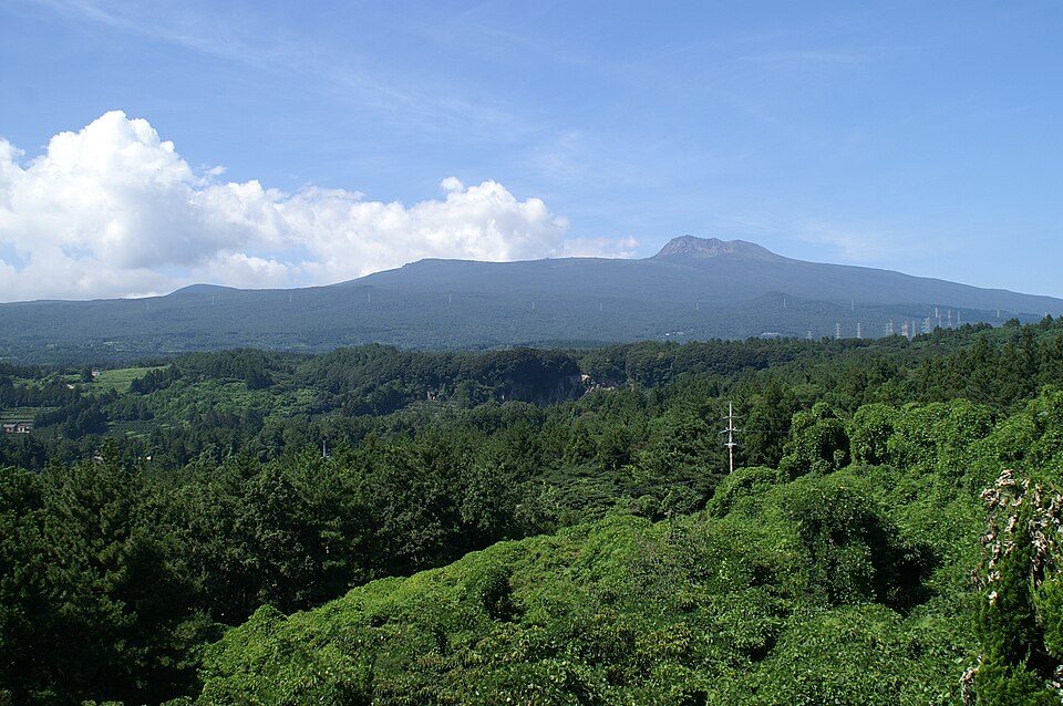
Day 4 · Hallasan in summerPhoto: Olga Lipunova · CC BY-SA 3.0 · source & licence ↗
DAY 04 · 6 days · 5 nights
Hallasan walking day
For a summit attempt, check the official trail reservation, entry time and live closure notices. Take food, water and layers; turn back by the official cutoff. Choose a shorter open route if a summit hike is unsuitable.
Carry your own food and water. Do not expect a restaurant on the trail.
How to change Day 4 for the weather
Rain: Do not start a closed or unsafe trail. Move the mountain day only if a valid reservation or open alternative is available.
Heat or cold: Carry a warm layer, water and food; check the official cutoff and turn back when needed.
Weather warning: Follow official warnings and operator notices. Keep the day near your base rather than forcing booked travel or an exposed walk.
Check the official forecast ↗ and current admission or trail notices for Hallasan walking day.
Nearby to see & do
These are optional places in the wider destination. Check the distance, opening day and journey before adding a stop.
Seongsan IlchulbongVisit the volcanic coastal landmark in eastern Jeju. Check current trail access and allow time for the climb if you choose the summit route. Visitor information ↗NAVER Map · English ↗KakaoMap · English ↗Google Maps ↗
Hamdeok BeachSpend time on the north-coast shoreline. Plan beach activities around weather, seasonal facilities and posted water-safety guidance. Visitor information ↗NAVER Map · English ↗KakaoMap · English ↗Google Maps ↗
Seogwipo Maeil Olle MarketBrowse the market during a south-coast day. Check individual stall hours and menus before arranging your meal around a particular vendor. Visitor information ↗NAVER Map · English ↗KakaoMap · English ↗Google Maps ↗
Hallasan National ParkChoose a trail according to its length and difficulty. Summit access and lower forest walks are different plans, and some routes require reservations. Use the official booking and trail-status service before departure; the mountain should have its own day and suitable equipment.NAVER Map · English ↗KakaoMap · English ↗Google Maps ↗
Hallasan Dulle-gil forest walksForest paths around the mountain offer an alternative to a summit climb. Select a named section and confirm where it begins and ends; the circular-trail name does not mean a short loop from any entrance. Arrange the return journey and check local access notices.NAVER Map · English ↗KakaoMap · English ↗Google Maps ↗
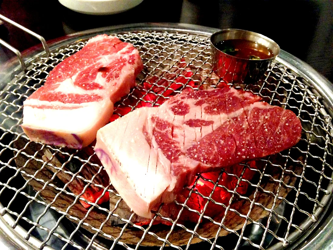
Day 5 · Jeju black pork barbecuePhoto: eommina · 2015-07-08 · CC0 1.0 · source & licence ↗
DAY 05 · 6 days · 5 nights
Weather reserve and north coast
Use this as a weather reserve for Hallasan only if you can change or obtain the required reservation and the trail is open. Otherwise enjoy a lighter coast or city day.
Examples of dishes, not booked restaurants. Check menus, ingredients, prices and opening hours on the day.
How to change Day 5 for the weather
Rain: Shorten exposed coast walks and use a sheltered market or museum only if open.
Heat or cold: Move outdoor stops toward a more comfortable hour and add water and a seated break.
Weather warning: Follow official warnings and operator notices. Keep the day near your base rather than forcing booked travel or an exposed walk.
Check the official forecast ↗ and current admission or trail notices for Weather reserve and north coast.
Nearby to see & do
These are optional places in the wider destination. Check the distance, opening day and journey before adding a stop.
Seongsan IlchulbongVisit the volcanic coastal landmark in eastern Jeju. Check current trail access and allow time for the climb if you choose the summit route. Visitor information ↗NAVER Map · English ↗KakaoMap · English ↗Google Maps ↗
Seogwipo Maeil Olle MarketBrowse the market during a south-coast day. Check individual stall hours and menus before arranging your meal around a particular vendor. Visitor information ↗NAVER Map · English ↗KakaoMap · English ↗Google Maps ↗
Hallasan National ParkChoose a trail according to its length and difficulty. Summit access and lower forest walks are different plans, and some routes require reservations. Use the official booking and trail-status service before departure; the mountain should have its own day and suitable equipment.NAVER Map · English ↗KakaoMap · English ↗Google Maps ↗
Hallasan Dulle-gil forest walksForest paths around the mountain offer an alternative to a summit climb. Select a named section and confirm where it begins and ends; the circular-trail name does not mean a short loop from any entrance. Arrange the return journey and check local access notices.NAVER Map · English ↗KakaoMap · English ↗Google Maps ↗
Dongmun Market, Jeju CityKeep this market with a Jeju City or airport-side day rather than combining it with a rushed south-coast visit. Look for local produce and meals, keeping airline baggage needs in mind. Leave a buffer for the airport transfer and any rental-car return.NAVER Map · English ↗KakaoMap · English ↗Google Maps ↗
Examples of dishes, not booked restaurants. Check menus, ingredients, prices and opening hours on the day.
How to change Day 6 for the weather
Rain: Shorten outdoor walks and choose an indoor museum or market only if open.
Heat or cold: Move outdoor stops toward a more comfortable hour and add water and a seated break.
Weather warning: Follow official warnings and operator notices. Keep the day near your base rather than forcing booked travel or an exposed walk.
Check the official forecast ↗ and current admission or trail notices for Return flight.
Nearby to see & do
These are optional places in the wider destination. Check the distance, opening day and journey before adding a stop.
Seongsan IlchulbongVisit the volcanic coastal landmark in eastern Jeju. Check current trail access and allow time for the climb if you choose the summit route. Visitor information ↗NAVER Map · English ↗KakaoMap · English ↗Google Maps ↗
Hamdeok BeachSpend time on the north-coast shoreline. Plan beach activities around weather, seasonal facilities and posted water-safety guidance. Visitor information ↗NAVER Map · English ↗KakaoMap · English ↗Google Maps ↗
Seogwipo Maeil Olle MarketBrowse the market during a south-coast day. Check individual stall hours and menus before arranging your meal around a particular vendor. Visitor information ↗NAVER Map · English ↗KakaoMap · English ↗Google Maps ↗
Hallasan National ParkChoose a trail according to its length and difficulty. Summit access and lower forest walks are different plans, and some routes require reservations. Use the official booking and trail-status service before departure; the mountain should have its own day and suitable equipment.NAVER Map · English ↗KakaoMap · English ↗Google Maps ↗
Hallasan Dulle-gil forest walksForest paths around the mountain offer an alternative to a summit climb. Select a named section and confirm where it begins and ends; the circular-trail name does not mean a short loop from any entrance. Arrange the return journey and check local access notices.NAVER Map · English ↗KakaoMap · English ↗Google Maps ↗
 Seolleongtang설렁탕A warm soup before or after travelIllustrative dish photo · Lee Dong-won / Wikimedia Commons · CC0 1.0
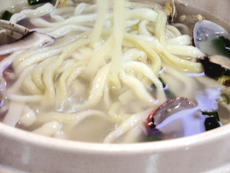 Kalguksu칼국수Warm knife-cut noodlesIllustrative dish photo · frakorea / Wikimedia Commons · CC BY 2.0
 Bibimbap비빔밥A rice bowl; compare ingredients and menusIllustrative dish photo · Douglas Paul Perkins / Wikimedia Commons · CC BY 3.0
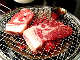 Grilled pork흑돼지구이Compare menus before orderingIllustrative dish photo · eommina / Wikimedia Commons · CC0 1.0