This is a suggested route, not a live timetable or a guided tour. Book tickets and verify operating days, local transfers and trail conditions before travelling.
1days
1planning areas
3mapped stops
1flexible route
FIRST, CHOOSE YOUR TRANSPORT
How will you travel?
Select the main travel option to update the day-by-day journey notes. Confirm that your chosen service runs on your travel date before buying tickets.
Showing Train + local transport directions. Check current bookings and maps before travel.
01 / TRAVEL
How to get there
Take ITX-Cheongchun from Yongsan or Cheongnyangni to Chuncheon; reserve your return service separately.
Check the forecast the evening before and again on departure day. For mountain days, check the official trail controls and booking rules too. These are planning alternatives, not live weather reports.
Photographs show the region or a stop on the route; the numbered list gives the order and live map links. Leave time for meals, local travel and changes in weather.
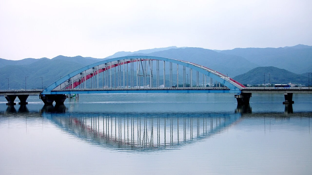
Day 1 · Second Soyang Bridge, ChuncheonPhoto: Joosung Kwon · CC BY-SA 3.0 · source & licence ↗
DAY 01 · Day trip
Lake views and local food
Use local buses or taxis between stops. Skip the final stop if your return train leaves early.
Examples of dishes, not booked restaurants. Check menus, ingredients, prices and opening hours on the day.
How to change Day 1 for the weather
Rain: Shorten outdoor walks and choose an indoor museum or market only if open.
Heat or cold: Move outdoor stops toward a more comfortable hour and add water and a seated break.
Weather warning: Follow official warnings and operator notices. Keep the day near your base rather than forcing booked travel or an exposed walk.
Check the official forecast ↗ and current admission or trail notices for Lake views and local food.
Nearby to see & do
These are optional places in the wider destination. Check the distance, opening day and journey before adding a stop.
Myeongdong Dakgalbi StreetMake time for Chuncheon’s famous chicken dish in the downtown food area. This is Chuncheon’s Myeongdong, separate from the Seoul neighbourhood. Visitor information ↗NAVER Map · English ↗KakaoMap · English ↗Google Maps ↗
Nami IslandNami Island belongs to Chuncheon, but the usual boat departure point is approached from Gapyeong. Plan the station-to-wharf transfer and the boat separately. A winter photograph shows one season only; the tree-lined paths look different through the year.NAVER Map · English ↗KakaoMap · English ↗Google Maps ↗
Samaksan mountain sceneryThe mountain landscape can be explored on a separately planned hike or through the area's visitor attractions. A photograph of the rocky summit does not establish the cable-car route. Confirm your chosen entrance, activity and return transport before leaving the city.NAVER Map · English ↗KakaoMap · English ↗Google Maps ↗
Obongsan regional outingThe mountain area spans Chuncheon and Hwacheon. Treat it as a dedicated nature outing with its own trailhead and transport plan. It should not be added casually after a city lunch, especially when daylight or the return train is limited.NAVER Map · English ↗KakaoMap · English ↗Google Maps ↗
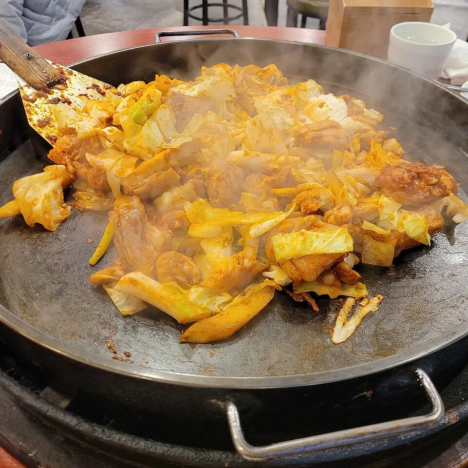 Dakgalbi닭갈비Spicy chicken cooked at the tableIllustrative dish photo · YellowTurtle9 / Wikimedia Commons · CC BY 4.0
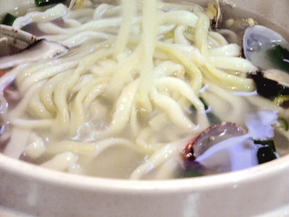 Kalguksu칼국수Warm knife-cut noodlesIllustrative dish photo · frakorea / Wikimedia Commons · CC BY 2.0
 Seolleongtang설렁탕A warm soup before or after travelIllustrative dish photo · Lee Dong-won / Wikimedia Commons · CC0 1.0