This is a suggested route, not a live timetable or a guided tour. Book tickets and verify operating days, local transfers and trail conditions before travelling.
3days
1planning areas
6mapped stops
1flexible route
FIRST, CHOOSE YOUR TRANSPORT
How will you travel?
Select the main travel option to update the day-by-day journey notes. Confirm that your chosen service runs on your travel date before buying tickets.
Showing Coach + local transport directions. Check current bookings and maps before travel.
01 / TRAVEL
How to get there
Take a coach from Seoul to Tongyeong and transfer locally to the harbour. Keep arrival day light.
Check the forecast the evening before and again on departure day. For mountain days, check the official trail controls and booking rules too. These are planning alternatives, not live weather reports.
Photographs show the region or a stop on the route; the numbered list gives the order and live map links. Leave time for meals, local travel and changes in weather.
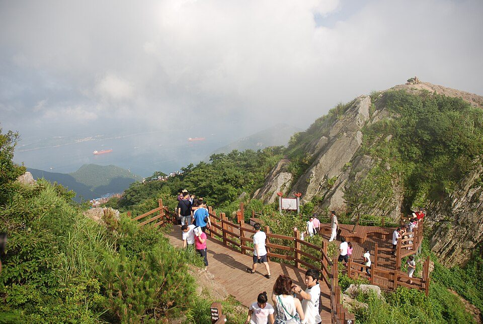
Day 1 · Mireuksan trail above the seaPhoto: Asfreeas · CC BY-SA 3.0 · Resized; thumbnail WebP · source & licence ↗
DAY 01 · 3 days · 2 nights
Arrive at the harbour
Leave your bags and start with a waterfront walk and dinner.
Examples of dishes, not booked restaurants. Check menus, ingredients, prices and opening hours on the day.
How to change Day 1 for the weather
Rain: Shorten exposed coast walks and use a sheltered market or museum only if open.
Heat or cold: Move outdoor stops toward a more comfortable hour and add water and a seated break.
Weather warning: Follow official warnings and operator notices. Keep the day near your base rather than forcing booked travel or an exposed walk.
Check the official forecast ↗ and current admission or trail notices for Arrive at the harbour.
Nearby to see & do
These are optional places in the wider destination. Check the distance, opening day and journey before adding a stop.
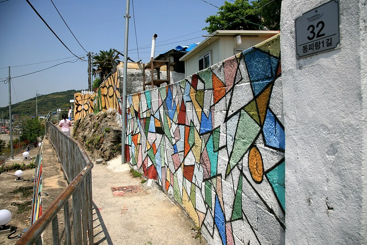
Dongpirang VillageFollow the hillside lanes above Gangguan for murals and harbour views. This is a residential neighbourhood with slopes and steps; keep voices low and avoid private doorways. Plan your visit: The colourful hillside lanes overlook Gangguan, but they remain residential. Choose a short signed route if the slopes are tiring, and keep doorways clear. Combine the walk with the market below rather than repeatedly climbing back and forth.NAVER Map · English ↗KakaoMap · English ↗Google Maps ↗
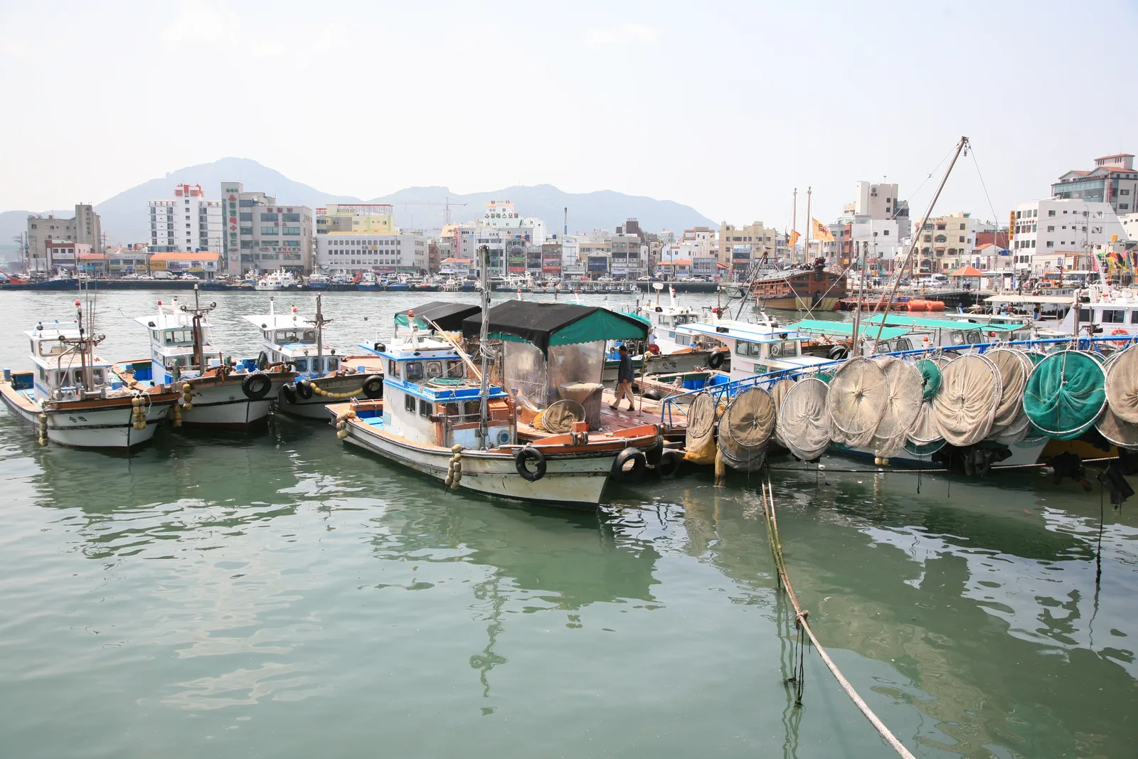
Gangguan & Jungang MarketExplore the harbour and browse the market beside Dongpirang. Fish, dried seafood and small food shops make it a good place to sample the city. Plan your visit: The harbour and market work together as a compact first stop. Browse fresh and dried seafood, then agree portion size and preparation before ordering. Individual stalls operate independently, so a market opening time does not guarantee every shop is available.NAVER Map · English ↗KakaoMap · English ↗Google Maps ↗
Mireuksan cable carConsider a cable-car trip for views across the southern islands. Check the operator’s hours, wind conditions and any remaining steps to the viewpoint before buying a ticket. Plan your visit: Check operating conditions and the actual boarding point before leaving the harbour. Reaching the upper station and walking onward on the mountain are different activities. Allow for queues, steps and the return transfer, and keep an alternative for windy weather.NAVER Map · English ↗KakaoMap · English ↗Google Maps ↗
Sebyeonggwan HallAdd a heritage stop at the former naval headquarters area. The large timber hall offers a different perspective on Tongyeong from the harbour and murals. Plan your visit: The historic hall provides context for Tongyeong's naval past. Pair it with the surrounding heritage district and a harbour meal. Check admission and any restricted areas, and take care around raised thresholds or steps.NAVER Map · English ↗KakaoMap · English ↗Google Maps ↗
Mireuksan walking pathsFor a longer nature outing, choose a named trail and decide how you will return. The photographed stepped path is not a promise of a step-free route from the cable car. Review the walking level and weather before adding a climb to a city sightseeing day.NAVER Map · English ↗KakaoMap · English ↗Google Maps ↗
Chungmu gimbap충무김밥Rice rolls with sides, a Tongyeong dishIllustrative dish photo · Junho Jung / Wikimedia Commons · CC BY 3.0
Examples of dishes, not booked restaurants. Check menus, ingredients, prices and opening hours on the day.
How to change Day 2 for the weather
Rain: Shorten outdoor walks and choose an indoor museum or market only if open.
Heat or cold: Move outdoor stops toward a more comfortable hour and add water and a seated break.
Weather warning: Follow official warnings and operator notices. Keep the day near your base rather than forcing booked travel or an exposed walk.
Check the official forecast ↗ and current admission or trail notices for Murals and history.
Nearby to see & do
These are optional places in the wider destination. Check the distance, opening day and journey before adding a stop.
Dongpirang VillageFollow the hillside lanes above Gangguan for murals and harbour views. This is a residential neighbourhood with slopes and steps; keep voices low and avoid private doorways. Plan your visit: The colourful hillside lanes overlook Gangguan, but they remain residential. Choose a short signed route if the slopes are tiring, and keep doorways clear. Combine the walk with the market below rather than repeatedly climbing back and forth.NAVER Map · English ↗KakaoMap · English ↗Google Maps ↗
Gangguan & Jungang MarketExplore the harbour and browse the market beside Dongpirang. Fish, dried seafood and small food shops make it a good place to sample the city. Plan your visit: The harbour and market work together as a compact first stop. Browse fresh and dried seafood, then agree portion size and preparation before ordering. Individual stalls operate independently, so a market opening time does not guarantee every shop is available.NAVER Map · English ↗KakaoMap · English ↗Google Maps ↗
Mireuksan cable carConsider a cable-car trip for views across the southern islands. Check the operator’s hours, wind conditions and any remaining steps to the viewpoint before buying a ticket. Plan your visit: Check operating conditions and the actual boarding point before leaving the harbour. Reaching the upper station and walking onward on the mountain are different activities. Allow for queues, steps and the return transfer, and keep an alternative for windy weather.NAVER Map · English ↗KakaoMap · English ↗Google Maps ↗
Sebyeonggwan HallAdd a heritage stop at the former naval headquarters area. The large timber hall offers a different perspective on Tongyeong from the harbour and murals. Plan your visit: The historic hall provides context for Tongyeong's naval past. Pair it with the surrounding heritage district and a harbour meal. Check admission and any restricted areas, and take care around raised thresholds or steps.NAVER Map · English ↗KakaoMap · English ↗Google Maps ↗
Mireuksan walking pathsFor a longer nature outing, choose a named trail and decide how you will return. The photographed stepped path is not a promise of a step-free route from the cable car. Review the walking level and weather before adding a climb to a city sightseeing day.NAVER Map · English ↗KakaoMap · English ↗Google Maps ↗
Examples of dishes, not booked restaurants. Check menus, ingredients, prices and opening hours on the day.
How to change Day 3 for the weather
Rain: Shorten outdoor walks and choose an indoor museum or market only if open.
Heat or cold: Move outdoor stops toward a more comfortable hour and add water and a seated break.
Weather warning: Follow official warnings and operator notices. Keep the day near your base rather than forcing booked travel or an exposed walk.
Check the official forecast ↗ and current admission or trail notices for A view before departure.
Nearby to see & do
These are optional places in the wider destination. Check the distance, opening day and journey before adding a stop.
Dongpirang VillageFollow the hillside lanes above Gangguan for murals and harbour views. This is a residential neighbourhood with slopes and steps; keep voices low and avoid private doorways. Plan your visit: The colourful hillside lanes overlook Gangguan, but they remain residential. Choose a short signed route if the slopes are tiring, and keep doorways clear. Combine the walk with the market below rather than repeatedly climbing back and forth.NAVER Map · English ↗KakaoMap · English ↗Google Maps ↗
Gangguan & Jungang MarketExplore the harbour and browse the market beside Dongpirang. Fish, dried seafood and small food shops make it a good place to sample the city. Plan your visit: The harbour and market work together as a compact first stop. Browse fresh and dried seafood, then agree portion size and preparation before ordering. Individual stalls operate independently, so a market opening time does not guarantee every shop is available.NAVER Map · English ↗KakaoMap · English ↗Google Maps ↗
Sebyeonggwan HallAdd a heritage stop at the former naval headquarters area. The large timber hall offers a different perspective on Tongyeong from the harbour and murals. Plan your visit: The historic hall provides context for Tongyeong's naval past. Pair it with the surrounding heritage district and a harbour meal. Check admission and any restricted areas, and take care around raised thresholds or steps.NAVER Map · English ↗KakaoMap · English ↗Google Maps ↗
Mireuksan walking pathsFor a longer nature outing, choose a named trail and decide how you will return. The photographed stepped path is not a promise of a step-free route from the cable car. Review the walking level and weather before adding a climb to a city sightseeing day.NAVER Map · English ↗KakaoMap · English ↗Google Maps ↗
Plan an island excursionAn island visit needs its own ferry timetable and weather check. Select a particular island and confirm both outbound and return sailings with the operator. Allow a spare margin before any onward coach, and keep identification and booking details available.NAVER Map · English ↗KakaoMap · English ↗Google Maps ↗
 Chungmu gimbap충무김밥Rice rolls with sides, a Tongyeong dishIllustrative dish photo · Junho Jung / Wikimedia Commons · CC BY 3.0
 Seasoned cockles꼬막무침Seafood; ask about raw ingredientsIllustrative dish photo · Bak Ga Sangmin / Wikimedia Commons · CC BY 4.0
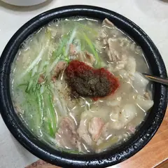 Pork soup & rice돼지국밥A hearty Busan soupIllustrative dish photo · chomjong / Wikimedia Commons · CC BY 2.0