Uhwajeong · pond and reflections
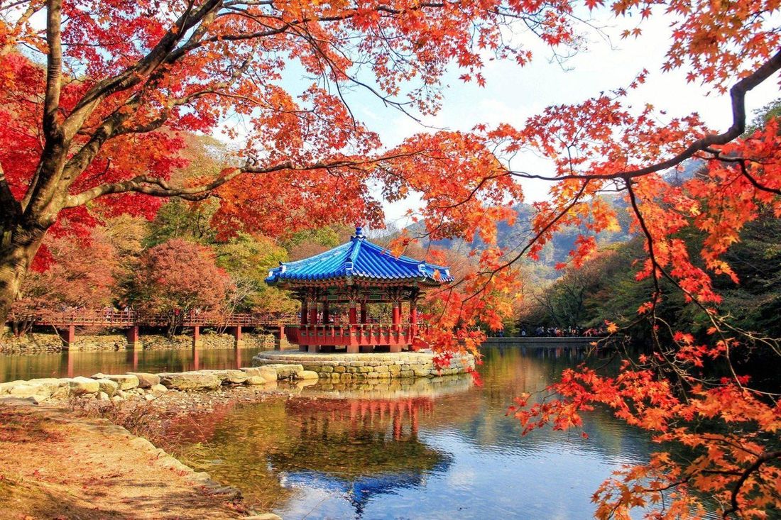
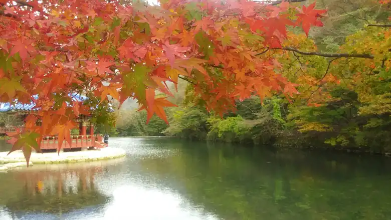
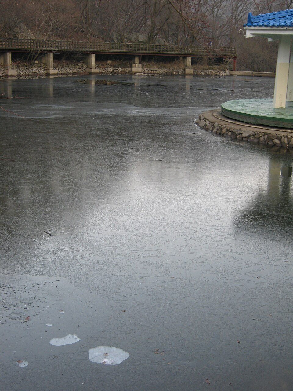
Photograph the pavilion together with the pond and surrounding maples from the open public path. Reflections depend on light and wind; the historic pictures here do not show today’s leaf colour.
JEONGEUP · JANGSEONG · 내장산국립공원
Maple avenues and quiet temples below; rocky summits above. Start with the kind of day you want, then choose the correct side of the park.
Sinseonbong: 763 m · Official course information reviewed 23 September 2026.
AUTUMN 2026 · JEONGEUP
This section covers the Jeongeup / Naejangsa approach. Jeongeup’s official announcement of 21 September 2026 sets out the dates below. The southern Baegyangsa approach has separate access arrangements. Checked 10 October 2026; times and service details may change.
| Item | 2026 dates / route |
|---|---|
| Vehicle restrictions inside the park | 30 October–15 November |
| Free circulator bus | Naejangho parking area ↔ Wolryeonggyo |
| City traffic / safety management | 26 October–22 November |
| Intensive management period | 31 October–15 November |
The city’s broader management dates are not the vehicle-restriction dates. The announcement identifies the free bus route, but does not give first/last departures, frequency or precise control-line boundaries. Confirm these before travelling. Do not assume the free bus goes all the way to Naejangsa, or confuse it with another internal shuttle or the cable car.
Parking / arrival → confirmed bus boarding point → Wolryeonggyo → signed walking approach → Uhwajeong → Iljumun → maple tunnel → Naejangsa → return
Editorial planning allowance: reserve about half a day for arrival, walking, photography and the return queue, then adjust to your actual start point and companions. This is not an official walking duration. Set a return time before you enter; keep cable-car travel as an optional addition after checking queues and the last descent.
Photograph the pavilion together with the pond and surrounding maples from the open public path. Reflections depend on light and wind; the historic pictures here do not show today’s leaf colour.
The park identifies the 108-tree avenue between Iljumun and Naejangsa. Photograph the canopy and a separate view along the path. Keep the passage clear and expect fallen leaves or wet, slippery ground.
“Seoraejeong (서래정)” has not been verified as a separate official stop in the sources checked. We do not assign it a guessed map pin. Seoraebong (서래봉) is the documented rocky peak and Byeongnyeonam is a separate hillside temple. A peak hike is an optional mountain outing, not part of the easy maple walk; check the seasonal reservation section and open trails before adding it.
These two numbers explain the transfer: 1 is the parking / bus-start area; 2 is the announced bus endpoint. They are not the temple or the summit, and the map is not a walking track. Find the actual boarding bay and the day’s permitted pedestrian route from the posted signs. Sightseeing locations are mapped in the existing autumn section below.
내장호주차장
내장산 월령교
Travel by rail or intercity bus to Jeongeup, then verify the local bus or taxi to the open entrance. An overnight stay in Jeongeup or the Naejangsan entrance area gives more flexibility for a morning visit. Confirm first/last transport, early departure, payment and cancellation conditions before booking. Parking, bus queues and the walking approach take extra time beyond the rail journey.
NAEJANGSAN IN FULL COLOUR
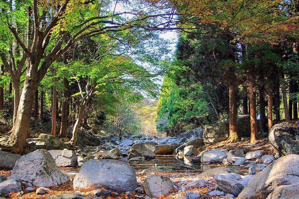
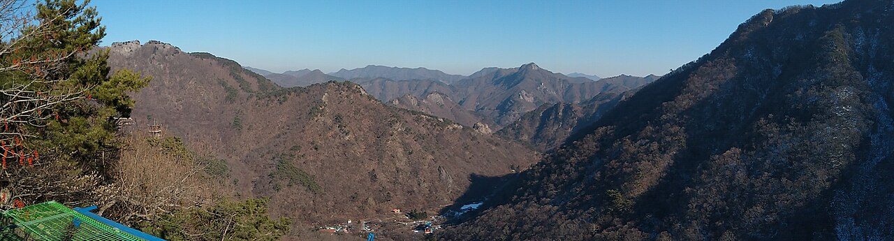
Look across the autumn canopy, then walk beneath the maple avenue. These photographs show different viewpoints and past seasons; the colour on your visit will depend on weather and timing.
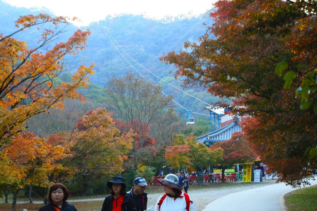
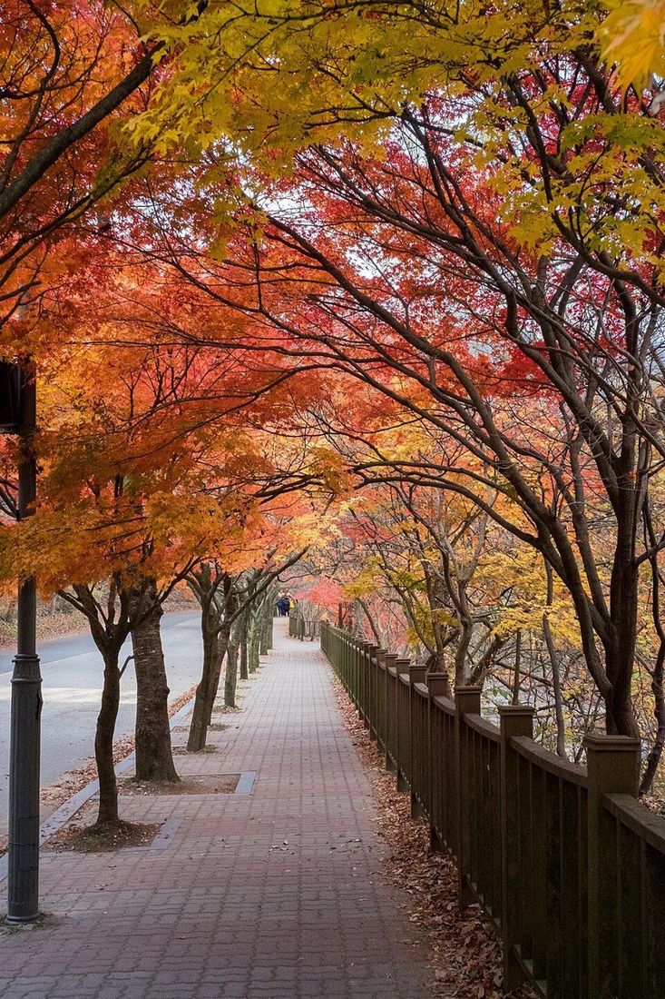
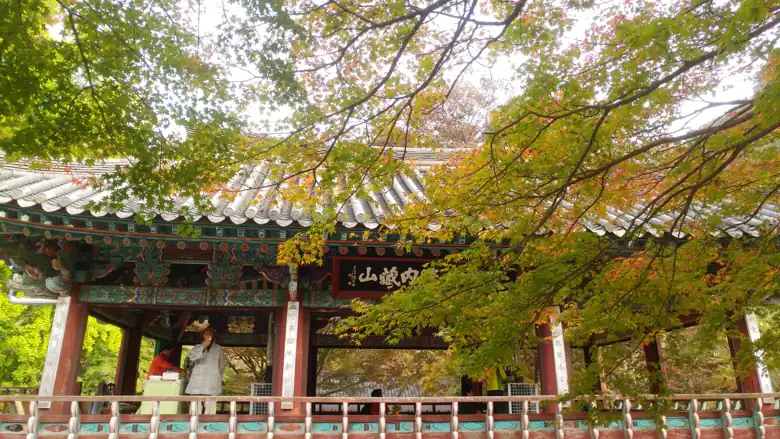
Archive photographs of different scenes, not live foliage conditions. Open each image for a larger view. Credits, original files and reuse licences appear below each photo. Images are resized and compressed for the web.

SHUNSHAN PIAO · Original · CC BY-SA 3.0
SHUNSHAN PIAO · Original · CC BY-SA 3.0
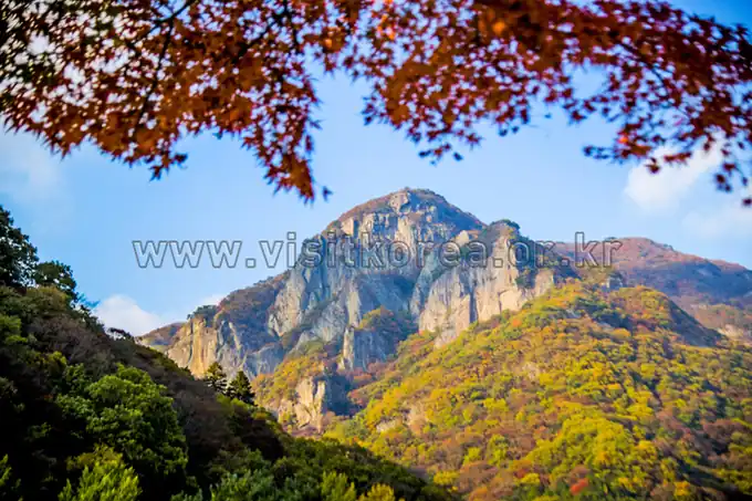
ⓒ한국관광공사 사진갤러리-두드림 · Original · KOGL Type 1
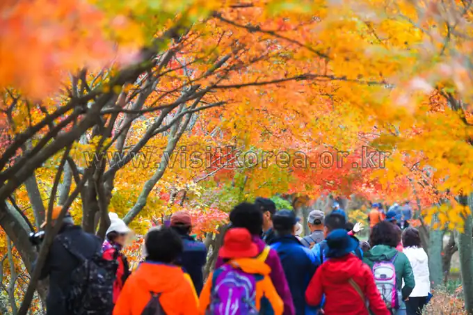
ⓒ한국관광공사 사진갤러리-두드림 · Original · KOGL Type 1
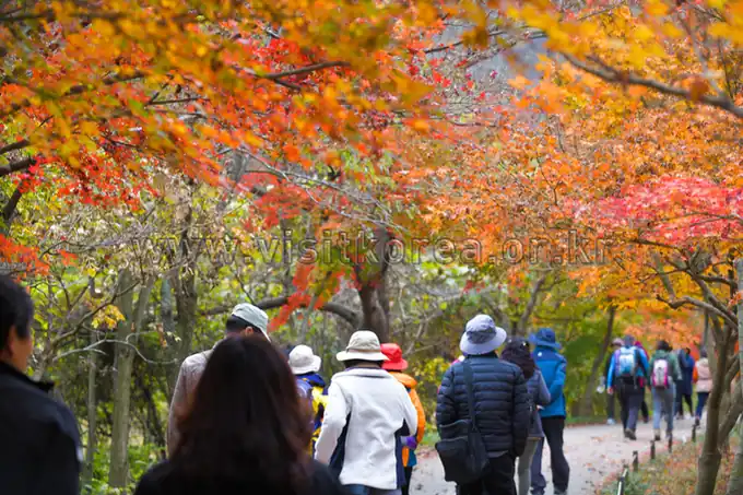
ⓒ한국관광공사 사진갤러리-두드림 · Original · KOGL Type 1
AUTUMN · JEONGEUP · 내장사
A maple avenue, Uhwajeong reflected in a pond and a temple below the rocky ridges. Make Jeongeup your base and keep the day focused on the northern temple approach.
Practical autumn plan reviewed 30 September 2026 · source-based planning, not a field visit or live transport feed.
The pavilion and colourful woodland reflected in the pond.
Photo & rest allowance: 20–30 min
View practical guideTung Thanh Dang · CC BY-SA 3.0 · Photo source
Walk beneath the red canopy on the temple approach.
Temple day allowance: 3–4 hr, including return
View practical guideNorton Ip · CC BY-SA 2.0 · Photo source
Time allowances are planning estimates, excluding transport. Photographs show past seasons; check current foliage and access for your date.
Historical photographs. Open a photo for the larger view; colour and conditions on your date may differ. Photos are resized for display; individual reuse licences apply.
내장산탐방안내소
내장산 우화정
내장사 일주문
내장사
The map locates places; the numbered list is a planning sequence, not a surveyed hiking track. Search results can be approximate. Match your start and junctions with the official entrance map and signs.
The KTO 2026 forecast puts Naejangsan’s mountain-wide peak around 11 November. This is a forecast, not a promise for the Naejangsa avenue: elevation, rain and wind change the colour. Check recent dated local photographs before fixing your visit.
Prefer a weekday morning if your dates are flexible. Our planning recommendation is one night in Jeongeup, then an early park visit; a Seoul day trip leaves less room for local-bus queues and traffic. The photographs here show earlier seasons, not today’s conditions.
Book a train to Jeongeup (정읍역), checking the Seoul departure station printed on your ticket. At Jeongeup, search Naver Map for 내장산탐방안내소 and inspect the walking leg as well as the bus leg. The bus approach is not the temple entrance.
Route 171 is a useful local-bus candidate; the regional ecotourism authority lists it on the Naejang reservoir–Jeongeup connection. Confirm your exact Naejangsan-bound variant, boarding side and final stop with the driver. We have not verified a current station-platform number, full timetable or autumn shuttle, so none is promised here.
Before walking, save the return stop and two usable departures. Keep at least 90 minutes of planning buffer between the expected arrival at Jeongeup Station and your train; increase it on busy weekends. If the bus is badly delayed, ask the visitor centre to help arrange a taxi rather than continuing deeper into the park.
Temple-focused visit: visitor centre → Uhwajeong → Iljumun maple approach → Naejangsa → return by the signed approach. Allow 3–4 hours as our planning allowance for photographs, rests and the return, plus the approach from the bus stop. Turn back earlier if tired. This is not a measured GPS route or a summit hike.
Longer woodland option: the city lists a 3.9 km nature observation loop, about 1 hr 20 min of walking, via Iljumun, Naejangsa, Wonjeogam and Byeongnyeonam. Add approach, rest and crowd time. Uneven ground and steps make this a different commitment from the temple avenue; do not describe it as wheelchair accessible.
Cable car: an optional extra, not the backbone of this day. Confirm operation, queue, fare and last descent with the operator before buying. If the queue consumes your return buffer, keep the temple walk instead.
Uhwajeong (우화정) is the pond-and-pavilion stop on the northern temple approach. Visit before continuing through Iljumun to Naejangsa. Look for a composition with the pavilion, water and wooded slopes together; calmer water gives clearer reflections, but wind and crowds can change the scene.
Allow 20–30 minutes within the temple day as an editorial photo-and-rest allowance. Use the public pond-side path and keep passage clear; avoid stepping onto the bank or into the water for a picture. The autumn photograph above is historical, so it does not establish today’s pavilion appearance or foliage.
Search for 내장산수목원 at 194-28 Naejanghoban-ro, Jeongeup (내장호반로 194-28). This is on the Naejangho side, separate from the visitor-centre → Uhwajeong → temple walk. Do not put it between Uhwajeong and Naejangsa or confuse it with the nearby maple ecology park.
KTO describes an arboretum with native trees, shrubs, flower beds, walking paths, a lawn, pavilion and toilets, with free admission. Plan 45–60 minutes for a relaxed look around, excluding the transfer; this is our allowance, not an official route time. Confirm current access and path conditions before travelling.
The arboretum’s red spider lilies are an early-autumn attraction: KTO places their flowering from September for roughly two weeks. Do not expect that bloom on a November maple trip. Enjoy the trees and garden instead; no unverified arboretum photo is labelled as an autumn scene here.
Near the arboretum, KTO identifies the outdoor sculpture park, Donghak Peasant Revolution memorial tower and Naejangho as related sights. Choose the garden plus one nearby stop, rather than treating them as extra stages of the temple hike. Use the separate map searches below to plan a safe connection.
Best fit: arrive in Jeongeup early on Day 1, confirm luggage storage, and visit the lakeside area before the next morning’s temple walk. By public transport, verify both the outward and return stops independently. If you have only a Seoul day trip, keep Uhwajeong and Naejangsa as the priority and omit this detour when it threatens your station buffer.
Day 1: arrive in Jeongeup, leave your luggage at an agreed storage point or your accommodation, eat dinner and optionally visit Ssanghwacha Street. Day 2: take the first suitable local connection, walk the temple approach, have lunch near the entrance and return to the station. Ask about luggage storage; do not assume lockers are available.
Day-trip version: reserve outward and return rail separately, do only the temple approach, and skip the nature loop or cable car if arrival is late. Do not add Baegyangsa: it uses a different southern approach and is not an adjacent stop.
Illustrative local-day allowance: ₩30,000–60,000 per adult for simple meals, a drink, local bus travel and a small contingency. This is our planning allowance, not a surveyed price or package. It excludes accommodation, intercity rail/coach, taxis, cable car and paid experiences. Check current charges independently.
Choose Jeongeup station/city for easier onward rail and more evening meal options; choose the park approach for a shorter morning journey only after confirming the accommodation’s exact position and food hours. A “Naejangsan” hotel name does not establish walking distance to Naejangsa.
Near the entrance, look for sanchae bibimbap (산채비빔밥, wild-vegetable rice) or a set meal. Ask whether one person can order and whether soup or sauce contains meat, seafood or fish stock. “Vegetable” does not guarantee vegan food. Carry water and a snack before entering; Ssanghwacha Street is in Jeongeup city, not beside the temple.
If the park closes a section, obey the barrier and shorten the visit to permitted ground; do not substitute a ridge hike. For heavy rain, stay in Jeongeup and choose an indoor tea stop or museum after checking its opening day. If colours are early or fading, explain that honestly and enjoy the temple and pond without promising peak red leaves.
Keep your phone charged, carry a warm/rain layer and shoes with grip, and use official location signs if asking for help. For park enquiries call 063-538-7875; in an emergency call 119. Return before your transport buffer runs out.
Review date applies to this autumn plan only. Check access, weather and transport again for your date. We do not claim a completed visit, booking, measured trail distance or current foliage observation.
WALK OR CLIMB?
Choose the nature observation loop for woodland, hermitages and autumn colour. Start at the Naejangsan visitor centre; allow extra time to reach it from parking or the bus stop.
See the nature loop →Compare Seoraebong with Sinseonbong. Both involve steep terrain; distance alone does not show the effort. Check reservations and open sections before setting off.
Compare summit courses →Baegyangsa and Namchang Valley are separate starting areas. Do not book transport to Naejangsa if your hike begins at Baegyangsa.
Choose the correct arrival point →OFFICIAL COURSES, CLEAR STARTS
Distances and times describe the routes listed by Korea National Park Service. They exclude your journey from the station, meals, photograph stops and delays. “One way”, “circuit” and “traverse” are different commitments.
Gentler woodland walk
자연관찰로코스
3.9 km loop · About 1 hr 20 min
Visitor centre → Naejangsa → Wonjeogam → Love Bridge → Byeongnyeonam → Iljumun
Choose this for forest, hermitages and a first visit without a summit. The park describes a relatively gentle trail, but it includes gravel, exposed stones and steps: it is not a step-free circuit.
Steep steps and rocky viewpoints
서래봉코스
5.9 km circuit · Allow about 4 hours
Iljumun → Byeongnyeonam → Seoraebong → Bulchulbong → Wonjeogam → visitor centre
Choose this for the park’s distinctive rock faces. Expect steep metal stairs and a demanding descent. The official overview gives four hours; allow additional time for rests and queues. The seasonal reservation section is separate from this full circuit.
Cable car plus walking descent
전망대코스
1.81 km official course · About 50 min, excluding queues
Visitor centre → cable car → viewpoint → Naejangsa → visitor centre
The park’s short course uses the cable car uphill and a trail downhill. The descent includes stone and wooden steps. A return cable-car ticket is a different outing. Confirm current operation, last descent and ticket conditions with the operator.
Full mountain hike · 763 m summit
신선봉코스
7.4 km circuit · About 5 hours
Visitor centre → Geumseon Valley → Sinseonbong → Kkachibong → Naejangsa → visitor centre
Choose this for the main summit and ridge scenery. The official sections total 3 km uphill and 4.4 km back via Kkachibong. Rocky ground and steep steps require proper hiking shoes. Do not enter the restricted Geumseon Falls area.
Demanding · Baegyangsa side
백양사종주코스
8.1 km traverse · About 5 hr 30 min
Baegyangsa → Yaksam → Baekhakbong → Sangwangbong → Sajabong → Cheongnyuam → Gain village
This starts on the southern side of the park. Steep stairs, cliffs and loose rocks make it a substantial mountain day. It ends at Gain village, not at the starting temple. Check Baegam-area closure notices before committing to this route.
Gentler gradient · different finish
장성새재코스
4.5 km one way · About 2 hours
Jeonnam University training centre → Jangseong Saejae → Ibam ranger post
A valley-and-pass alternative to a rocky summit. The official sections total 2.5 km plus 2 km. There are stony stretches and stream crossings. This is not a loop: arrange transport from the far side or plan a longer return along the same trail.
BEFORE YOU BOOK OR WALK
The reservation page identifies the 2.8 km section from Seorae visitor support centre to Byeongnyeonam. This is not the 5.9 km circuit above. Confirm the applicable dates, entry window and availability for your visit.
The park published a 2026 reservation notice and a Baegam-area access restriction notice on 7 September. Check the exact affected section; this guide does not display live open/closed status.
Park enquiries: 063-538-7875 · Baegam office: 061-392-7288 · Emergency: 119.
SAVE THE KOREAN PLACE NAME
Plan your rail or intercity-bus journey to Jeongeup, then check the local connection to the Naejangsan entrance. The visitor centre is inside the park approach: allow for walking beyond the bus stop or parking area.
For the southern routes, plan your arrival around Jangseong or Baegyangsa Station and check the onward bus or taxi. Baegyangsa Station is not the temple entrance. Save the return pickup point before walking.
Use the Namchang Valley approach for Jangseong Saejae. The official course finishes at Ibam ranger post on the other side. Arrange pickup there before choosing a through-walk.
For the seasonal Seoraebong section, search 서래탐방지원센터, 266 Naejanghoban-ro, Jeongeup. It is a different gate from the main visitor centre.
This map locates arrival points; use the official park trail map for the mountain route.
BEYOND AUTUMN
| Season | What to plan for |
|---|---|
| Spring | Check fire-prevention closures before choosing a ridge. Carry a warm layer for higher ground. |
| Summer | Heat, humidity and heavy rain affect walking pace and stream crossings. Turn back at flooded crossings. |
| Autumn | Colour varies with weather and elevation. Allow for traffic, parking queues and busy trails; check seasonal entry reservations. |
| Winter | Ice can remain on shaded stairs and rocks. Check the forecast and closures; carry suitable footwear and traction. |
No. The park describes it as relatively gentle, but it includes steps and uneven surfaces. Ask the visitor centre for a suitable accessible section if needed.
No. The listed viewpoint course reaches the viewpoint area, not the 763 m summit. Check operating conditions separately from trail access.
They are on different sides. A mountain crossing is a separate, demanding route with return-transport implications. For a sightseeing visit, plan road transport between areas.
Water, food, grippy walking or hiking shoes, a rain layer, a charged phone and a saved return route. Add warm clothing and traction for cold or icy conditions.
Choose Jeongeup or the Naejangsan entrance area for northern courses; choose the Jangseong/Baegyangsa side for southern courses. Eat and buy supplies near your arrival area before entering the trail. Check opening times and the final return connection.
Call 119 in an emergency. Read out the nearest numbered park location sign, your course name and the last landmark. Save the park office number before entering.
Sources: Korea National Park Service course descriptions and reservation guidance, reviewed 23 September 2026. Photographs are credited individually. Schedules, fees and access can change; verify before travelling.
READY TO PLAN?
Click Biondi to chat. Drag the top bar to move this window. AI answers may need checking.
Where would you like to go?